How to find a catchable edge on a pond?
Finding a catchable edge occurs in several ways. The easiest way to determine the depth of the slope is by the angle of the fishing line or braided cord going into the water. But this will be only an initial and imprecise definition. Next, you should cast to the point of maximum distance from the shore from which the cast is made. The depth at a given location can be determined by the time the marker weight falls to the bottom. But the drop time of the weight must be tested in advance on some familiar body of water where the depth is known.
After determining the depth of the reservoir at different distances of casting the weight, an approximate map of the bottom relief is created. All that remains is to stretch the weight along the bottom to determine where the edge is. This will be noticeable by the way the weight begins to clearly touch the shell rock and grass, rest against it and forcefully climb onto the edge. In a hole, the bottom is usually smooth and there are rarely snags, unless of course it is a channel hole and not a pool under a steep bank, where there are a lot of driftwood. When the edge is found, you can clip the cord and start fishing on the feeder.
Types of edges
As a rule, a distinction is made between bank and channel edges:
- Coastal edges . They are found in all types of reservoirs, except for some small and silted ones, where the very concept of “edge” is absent. Sometimes there are several such edges due to the multi-stage nature of the bottom relief. Coastal edges are especially important for those fishermen who practice fishing with feeder gear or any other method of bottom fishing. In addition, they are coveted by spinning anglers who prefer fishing from the shore.
- Channel edges . Characteristic of reservoirs and large rivers. They are distinguished by their great length. On reservoirs, such edges are located in the beds of the rivers that formed the reservoir and are often located far from the shore. On rivers, channel edges are also located closer to the middle, but sometimes they can be located close to the bank on a concave (outer) bend of the river. Fishing on channel edges is especially popular in winter. During this period, in addition to general accessibility, such places are characterized by a large concentration of fish. In summer, fishing on channel edges is in most cases only possible from a boat.
Exit from the pit
Most often, for the average fisherman, the river is divided into certain places - where it bites and everything else. That is why questions like “Tell me a place where I can catch fish and relax” are often encountered. And no matter how much such questions infuriate us, we must admit that yes - rivers have places where fish are caught, and there are places where they are either not caught, or have a narrow specificity of fishing. Some catching places are somewhat similar, although they are located on different rivers and even in different basins. And even on other continents.
One of these characteristic places is the smooth exit from the pit. That is, if a hole, say, has a depth of 9 m, then for at least one hundred or two hundred meters downstream the depth decreases to four or five meters. If you go even smaller, then the narrow specificity that I mentioned begins. You can try to catch asp, saberfish, chub, and ide with appropriate baits. But the way out of the hole, especially if there are lonely snags in it, should work according to the predator.
Whether there is bottom relief there or not, whether there are steep edges there or not - that’s another question. The main thing for me is to get out of the hole. It is the exit, not the entrance! I don’t know why, but at the entrance to the hole I can’t catch fish worse. Perhaps I just haven’t understood the specifics yet. But the exit is often flatter than the entrance. It is easier to adapt to the current. And as soon as the weight began to tap the bottom, an understanding of the presence of other characteristics inherent in catchable places already appears. We will talk about them (edges, steps, “beds”) a little lower.
And now I would certainly add one important point. Not all pits are alike. I’ll explain to those who didn’t let boats sail on streams as children. Any change in depth in the river leads to a change in its flow, not only in the horizontal plane from bank to bank, but also in the vertical, diagonal - whatever! Why this happens is a topic for someone's dissertation. I'm just basing this on my observations.
All holes have uneven edges. There may be “pockets” with a reverse flow, there may be steeper or flatter edges of the depression itself, and there may be a different nature of the bottom in one or another section of the edge of the pit (for example, shell rock or clay platform). Of course, only time will help discover these secret anomalies
I say this only to emphasize the importance of the very concept of “getting out of the hole.” I think that any hole, be it straight or with a turn, holds back the main stream of the current
The volume of water is greater, the flow slows down. Maybe in the hole the current hits the shore - and this also slows it down. It seems to me that this is what attracts fish there to spend a sufficient amount of time during the day so that we can catch them there.
There is no need to make any special requirements for spinning rods in such places. The flow is slow. You can catch whatever you are used to. My friend fishes with a Stinger Power Age spinning rod, and I often alternate between the Nordic Stage Scout, Hearty Rise Evolution and the budget Team Dubna Champion. I'm interested in how different forms behave under conditions familiar to me. The most disgusting thing is that I didn’t scold a single spinning rod. One of two things: either I’m lucky, or ours have learned to offer Russian spinners normal models. Sorry for such a deviation in terms of materiel.
Well, where does the force of the main current go? But just for blurring - or maintaining the shape of the pit. Where the treasured “pocket” will be washed depends on the type of land through which the river flows. But we'll talk about this later
Now I want to draw your attention to the fact that if you are fishing from a boat or can reach any edge of the hole from the shore, you definitely need to pay more attention to these very edges of the hole. Once upon a time on Erik Banny, which is opposite the village
Selitrennoye (Astrakhan region) quite by accident I came across such an inconspicuous “pocket”.
Someone called me, I turned off the engine, and the wind and current began to carry me somewhere towards the “stupid” shore. And suddenly the echo sounder squealed, as if its wires had been pulled out to the very tips. There was a flock of silver bream standing here. Then it’s a matter of technique – finding pike perch and pike. And the pit itself was completely empty, both in the center and on the side of the washed-out bank.
A similar situation occurred on Akhtuba below the famous Three Rivers.
We climbed the entire hole - and the echo sounder does not show any fish. How can this be? But my persistence yielded results. For some reason the fish huddled in the very corner located closer to the gently sloping shore. Well, again, I discovered this fish largely due to the fact that I more carefully examined the river just around the bend at the supposed weakened current.
Fishing process
Fishing behind the edge is very interesting and dynamic. If you manage to set the table, then the bites follow one after another. Even in late autumn and early spring the bite here is good. The main thing is to choose a feeder of the desired shape and weight and learn how to pull it over the edge with a fish on the hook. At the same time, you need to feel the jerks of the fish and understand when to pull and when to release the clutch in order to let the fish walk a little.
If there is a small hill behind the angler, then it is better to climb onto it and try to catch fish with the feeder raised. As a result of these actions, it is possible to raise the fish to the required height and bring it to the shore. Those who use feeder platforms can climb on it and stand up to catch fish.
But bites more often occur on the outer rods. And the further downstream an angler sits, the better his fishing. This is easy to explain, since a lot of food delivered by neighboring fishermen is carried closer to his point and more fish are concentrated in this zone. In order not to feed the neighbor’s point, it is better to use more viscous compounds and mix them with molasses or hemp oil.
In this case, the fish will linger in your area. This applies more to large fish. If the goal of your fishing is roach, white bream and silver bream with blue breams, then fish with any bait. The concentration of these cyprinids on a normal river is such that in warm weather different fishermen will bite.
Usually, behind the edges, the depth at the fishing site is 3-5 meters. If it is 2 meters before the edge, then after it it is often 4-5 meters
Such differences are very promising for feeder fishing. During the fishing process, it is important to be able to combine with different baits and find new keys to the fish. For example, we see that bluegill and large silver bream are biting more often today
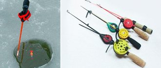
Catching pike in a pit with live bait
This method of hunting pike in a hole is among the most effective, especially in those where there are significant differences in depth.
Tackle
They catch the predator almost vertically, using spinning rods that have the ability to catch quite large specimens. The reel can be used with any of the available reels, which can cast over 20 m and, naturally, have sufficient power for such fishing.
The fishing line used is monofilament, with a total length of 80...100 m, having a breaking load of 8 kg. 2...4 sliding olive weights are placed on it with a total weight of 7...10 g. The free end is equipped with a swivel, to which a leash with a single hook No. 8...No. 12 (according to domestic numbering) is attached.
The leash is used from monofilament measuring 0.5...0.7 mm. As follows from practice, a toothy fish rarely has time to bite it before it is fished out. There are certain requirements for the manufacture of a leash and for its use. They are as follows:
- the leash is made only (!) from new fishing line; previously used is not suitable;
- after an empty bite or fishing for a pike, the leash must be changed to a new one;
- After completing 5...6 casts, you should carefully inspect the leash and replace it at the slightest suspicion of a defect.
Fishing technique
The boat is anchored 5...10 m before the hole, approximately in its middle. A shorter distance applies to holes with a rather steep entrance, a greater distance if the slope is gentle or the water in the reservoir is clear. Live bait is cast to places of greatest depth. Wiring is carried out, trying to ensure the passage of live bait as close as possible to the direction of the current.
After installing the boat, make 1…3 casts without hooking any live bait. This is done to assess the snags or clutter of the dump and to accurately determine the load of the gear. The latter is kept as minimal as possible, which allows the bait to move more freely in the water column and is less traumatic for it when casting.
Read: Making a spinner with your own hands
The live bait is hooked through the nostril. For bleak or roach, whose upper lip is weak, the lower lip is pierced and the hook is pulled out through the nostril. The latter option is less preferable, as it leads to the rapid death of live bait.
Tackle with live bait is thrown into the area directly from the pit. Allow the sinker and live bait to sink to the bottom. They wait for some time, after which they drag the bait to the base of the dump, then, if there are no bites, higher. And so on until the boat docks.
River edge in the life of a fisherman
In summer, fishermen often delight their families with a fresh catch. In winter, driving past a river or small lake, you can see that the ice is strewn with black dots of patiently frozen figures. At the same time, some areas remain free, while in others people sit next to each other. Experienced fishermen focus on the bottom topography. They know that the size of the catch largely depends on the right location. The bottom of any reservoir is uneven. Pits, hills, steps stand out. Each element has a name: channel, dump, navel, watering, reach, roll, edge.
The edge is the most important area. This is where all the fish species living in the reservoir feed.
Determining the location of the edge at the bottom of the lake is quite difficult, since the surface of the water is stationary and there is no understanding of how the water moved at the time of its formation, or how the soil moved. Traditionally, one shore of the lake is steep, the other is flat. Man-made bodies of water are also unpredictable. Reservoirs are artificial and deep and are studied using echo sounders.
The river topography is the most stable, it is formed by the current. Therefore, finding the edge at the bottom of the river is quite easy.
What is an "edge"
Those who are not familiar with the terminology and have not encountered the concept of a river edge should figure out what it is.
In places where fast currents or strong turbulences of the flow wash away soil from the bottom, the depth of the river changes. Sometimes the bottom goes down slowly, almost imperceptibly, sometimes it ends abruptly. The slope is called a slope, the flat parts are called a table, and the places where the breaks are called edges. Some call the entire slope the edges, but this is incorrect.
Eyebrows are distinguished according to the following main characteristics:
By location relative to the water surface:
- The top one is closer to the surface of the water; it marks the transition from a flat table to the beginning of the drop.
- The lower one, accordingly, is located lower, where the slope goes back into the table or shelf, if there are several height differences.
By distance from the coast:
- Beregovaya – located closest to the shore.
- Channel - frames the edges of the channel.
When the water is warm, fish accumulate near the shoreline. It is convenient because it has access from the shore. Later, with the arrival of cold weather, the fish go to feed deeper, to the riverbed edges.
Recommended reading: What is a river? Definition: a river is
Depending on whether it belongs to one of the elements of the bottom topography, the edge can be:
- Part of a ditch.
- Part of the pit.
Sometimes the current creates oblong depressions - ditches. Of these, the channel one, located in the center of the stream, is at the lowest point. In fact, this is an additional deepening in the riverbed.
Those that appear closer to the banks are near the riverbed, higher. They are much smaller in size. A short riverbed ditch is often considered a pit. It is only possible to accurately determine the size using an echo sounder.
The edge of the river is not always a straight, even line. There are parts protruding into the channel. They are called "tongues". The bends towards the shore were given the nickname "pocket".
Rivers are mobile; currents, channel locations, and bank boundaries change over time. Consecutive depth differences are formed. Then you get whole ladders of steps, with horizontal sections - shelves.
Medium-sized predators like pike, pike-perch or perch lurk here. The design of the shelves allows you to successfully lure fish onto the hook. But determining their location without available means is quite difficult.
Occasionally there are irrigations - smoothly rising wide areas between two edges or an edge and the shore.
Bottom irregularities are considered important for a reason. Small food accumulates on the sloped surface. It attracts small fish, which rush to collect food before it is carried away downstream.
Small fish attract large predators. They hide in the depths and catch their food at the lower break. So, if a friend tells you that he caught a huge catfish on the edge, he is definitely talking about the bottom.
Much depends on the depth of the hole and the river itself. If the river itself is small, then you need to look for fish at the very bottom. If it is full-flowing, then the bends of the relief are interesting.
Catfish, bream, and large pike perch climb the lowest. Among the daredevils who get closer to the dump there are perch, pike, ide, roach, and small pike perch. Pike hunts at any time of the day; catfish and pike perch prefer the night. Good fishing spots are never empty, so there is often a queue.
Unnatural miracles. In the Urals, the water in the river turned silver, and the banks became colored
Unnatural miracles.
In the Urals, the water in the river turned silver, and the banks were colored. In the Sosnovsky region, contractors generously poured paint on the Bilgilda River when repairing a bridge. Gardeners are worried about where to get water for irrigation from now? And who will be responsible for the silver paint in the river? Correspondent of the State Television and Radio Broadcasting Company "South Ural" Natalya Malinina understood the problem. Who muddies the water in the river? Gardeners of SNT “Zheleznodorozhny” have been asking this question for several days now. They say that after Birgilda was covered in a gray film, and the acrid smell of paint hung in the air, it became scary to approach the shore. Where does this water go now? The owners of 6 acres are indignant.
Most of all, summer residents worry about the harvest. After all, water for irrigation is taken from here. Now it is gray-brown. Most likely the bridge supports were painted silver. They left it everywhere, they even threw away their gloves in a hurry. Local residents, and the village of Butaki nearby, complain about the death of fish after such painting. And most likely this is just the beginning. Inspectors have already come to the bank of the river, which flows into the Shershnevskoye Reservoir, although they refused to introduce themselves.
Unnatural miracles. In the Urals, the water in the river turned silver, and the banks became colored
Unnatural miracles. In the Urals, the water in the river turned silver, and the banks became colored. Photo: multilisting.su The modest employees turned out to be employees of the municipal enterprise “Production Association of Water Supply and Sanitation” of Chelyabinsk. They never talked on camera. The situation was clarified by the regional Ministry of Ecology.
But no one can say for sure what harm the paint will cause to the reservoir and its inhabitants. We need to wait for the results of laboratory tests. After this, it will be possible to talk about sanctions for the perpetrators.
So far, only gardeners have been punished. If the water turns out to be unsuitable for irrigation, few pensioners will bring life-giving moisture to their plots from the nearest well.
Information service cheltv.ru
River edge in the life of a fisherman
In summer, fishermen often delight their families with a fresh catch. In winter, driving past a river or small lake, you can see that the ice is strewn with black dots of patiently frozen figures. At the same time, some areas remain free, while in others people sit next to each other. Experienced fishermen focus on the bottom topography. They know that the size of the catch largely depends on the right location. The bottom of any reservoir is uneven. Pits, hills, steps stand out. Each element has a name: channel, dump, navel, watering, reach, roll, edge.
The edge is the most important area. This is where all the fish species living in the reservoir feed.
Determining the location of the edge at the bottom of the lake is quite difficult, since the surface of the water is stationary and there is no understanding of how the water moved at the time of its formation, or how the soil moved. Traditionally, one shore of the lake is steep, the other is flat. Man-made bodies of water are also unpredictable. Reservoirs are artificial and deep and are studied using echo sounders.
The river topography is the most stable, it is formed by the current. Therefore, finding the edge at the bottom of the river is quite easy.
Types of main reservoirs and their features
Each type of reservoir has its own bottom topography, which is formed naturally or artificially.
The main types of reservoirs characteristic of our country:
River
It has the most predictable bottom structure. Most rivers are meandering streams of water with an unlimited number of turns.
The bottom topography depends on the currents existing in the rivers.
By looking at the trees growing along the rivers and the soil on the banks, you can predict what exactly is hiding at their bottom. Additional signs indicating underwater landscapes may include differences in the width of the channel, the presence of eddies and flows, snags and driftwood protruding above the surface, islands of vegetation, etc.
Lake
Usually occurs after a river flood or a change in its bed. As a result, calculating exactly where the edge is located on the bottom of the lake becomes a difficult task. Most often, one lake shore has a flat structure, and the other is steep.
It is easier to calculate the edge on artificial lakes and ponds formed after digging pits, extracting natural resources, dug for fish breeding, etc.
Reservoir
It has a vast water area, which is often impossible to survey without special instruments - echo sounders. Despite their external differences, all reservoirs have one common feature - this is a flooded river bed, which is always much deeper than the main bottom.
But still, it is the rivers that are the main place of pilgrimage for fishermen. And the point is not only that it is easiest to spot underwater obstacles, but also because there are often much more fish there than in a remote lake. In addition, river fish are much stronger and more energetic than pond fish.
Fighting a worthy opponent is always more interesting than fighting a slightly resistant individual that does not have to survive in places with strong or moderate currents.
Search for an edge
Only the heroes of fairy tales, throwing a net directly from the shore into the blue sea, can catch the “Golden Fish”. In reality, fish are resourceful and cunning. The fisherman must carefully study the underwater terrain and find the very place where the bite will be. This requires a good boat, dexterity, courage and healthy perseverance.
Seasoned fishermen have developed several sure-fire ways to find the edge on the river.
Visually
The easiest way to search is visual. It does not require special skills, only keen vision and knowledge.
Through clear water, the bottom pattern can be seen without any auxiliary equipment.
The saturation of the color of the water surface helps to detect the edge. Deeper places, where the water layer is thicker, acquire a dark color; in shallow water the color of the water is lighter. The more sharply the bottom level changes, the more clearly the break is visible. It should be looked for where the color border passes.
Another identifying feature is reeds, the roots of which are located at a depth of 1.5-2 m. If the thickets are uniformly dense, the eye will immediately highlight unovergrown clearings. Obviously, there is an edge along the border of their growth. This method will not work if the reeds grow too sparsely.
There are other external signs by which experienced specialists find edges and holes. For example, they visually determine the boundary between fast and slow currents.
Probing the bottom
It happens that the water in the river is muddy, dark like a swamp, and peaty brown. Then one of the palpation methods will help.
Wiring
Wiring means gradually smoothing the bottom with a weight. This takes a lot of time, but allows you to fully familiarize yourself with the topography of the reservoir.
A drop-shaped weight is tied to the end of a strong fishing line - it clings less, and is thrown in the direction of interest
After waiting until the drop reaches the bottom point, carefully pull it back. The feeling in your hands determines which surface the weight is moving on.
If the line shakes, the weight moves over rocks or shells. If it is wound tightly, the weight gets stuck so that you have to periodically lift the feeder, which means the edge has been found. You need to throw it many times. Each cast will show something new on the map of the underwater landscape and will add to the fisherman’s experience. In addition, there may be large stones under the water; an inexperienced person may be deceived.
Beginners are advised to try this method on land first. Find a suitable area and throw the fishing rod into a shallow ravine or over a gentle hill. This will help you clearly see what obstacles are preventing the weight from moving. It is worth remembering that moving objects in water is much easier than on land. The braided cord has good sensitivity.
We study the relief.
In each body of water, the bottom has its own special relief; artificial reservoirs are no exception. Everywhere water can change the topography. In addition, the amount of silt may increase, various inhabitants appear that can adjust the surface and dig holes. The intensity of the bite depends on these factors.
In such reservoirs it is much easier to find an edge than in closed water areas. Everything is quite simple in rivers; you can find sudden changes in a few minutes. As a rule, in most rivers there are 2 edges, one is located near the bank, the second is near the riverbed.
The edge, which is located next to the channel, is part of the ditch that is washed by the current from the main channel and is located near the very center. The coastal edge is most suitable for fishing, as it is located close to the shore.
When the weather is warm outside, the edge that is located next to the coastline is simply an ideal place for fishing. When cold weather sets in, you have to move closer to the riverbed.
In very rare cases, the dump has a straight relief. Most often these are rapids on which there is a huge amount of food. Quite a lot of peaceful fish come to these places in search of food.
Read: The most catchy winter lures for pike perch
In turn, a predator seeks after her. The upper rapids on such edges are ideal for catching small fish, especially perch, roach, and so on. In order to catch large fish, the equipment should be cast to the lower steps of the edge.
It is also worth paying attention to the so-called tongues, these are areas with shallow depths that are directed towards the center of the mouth. In addition, there are pockets that form an arc closer to the banks
How to find these places? Let's look at the main methods:
Visually. A few years ago, most fishermen could find a good fishing spot based solely on personal experience. The best places were considered to be thick reeds, driftwood, and places with countercurrents.
At the moment this knowledge is not enough. Places that can be seen visually are most often occupied by professional fishermen, and the fish no longer grab all the bait in a row.
Feeder wiring.
You can simply use this tackle, preferably using a heavy round-shaped load. It is best to use a braided type cord, with soft wiring without sudden movements.
When the rig passes over uneven areas, you can immediately feel it. In order to find the ideal spot, a professional only needs to cast the rig about 5 times.
Posting with a jig.
This option is called stepped wiring. The feeder is considered a fairly popular piece of equipment, despite the fact that many prefer the classic version of the spinning rod. In this case, you will have to make a little more casts compared to the previous option.
Wiring is used in a stepped type with a particularly heavy load so that it is not carried away by the current. Casts must be made in a certain direction, as far as possible. As soon as the load touches the water, it is worth timing.
To do this, you can use a stopwatch, or simply count the time to yourself until the load hits the bottom. The time difference is a signal that a hole or edge has been detected.
If the depth gradually increases, then an edge has been detected. These methods are the simplest and most proven. In addition to the methods listed, the easiest way is to use an echo sounder.
Happy fishing everyone! You can find even more interesting things at this LINK. And also read: What gear is suitable for autumn pike fishing?
We identify river edges and shallow holes
The second method is somewhat more complicated, but it allows you to determine not only edges, but also shallow holes. As in the first case, we make the longest first cast and wait for the load to fall to the bottom. This can be felt by the characteristic push into the handle of the feeder rod and by the state of its tip. Then we make two sharp turns with the reel, after which we count until the load falls to the bottom again. This should happen on the count of 1 – 2 or 1 – 2-3
In this case, it is very important to choose the correct weight of the load. If it takes less time, the load is heavy, it will be difficult to make calculations
If it is more, the load is light and is carried away by the current.
We continue to select the fishing line at intervals of two sharp turns of the reel. The counting results at each point can be stored or recorded. As a result, we get approximately the following table of counting data by points every 2 revolutions:
- Point No. 1 3sec
- Point No. 2 3 sec
- Point No. 3 5 sec
- Point No. 4 8 sec
- Point No. 5 4 sec
- Point No. 6 3 sec
- Point No. 7 3 sec
And so on. For example, there are 23 measurement points over the entire casting distance. Analyzing the measurements taken, we come to the conclusion that at points No. 1 and No. 2 the load is dragged along a flat section of the bottom, at point No. 3 the bottom begins to fall, point No. 5 is the deepest part of the pit, at point No. 7 a flat section of the bottom begins again .
The most interesting and promising point for fishing will be point number 5; all that remains is to fix the distance, which is the distance to it, on the main fishing line. Let’s say we got a total of 23 measuring points, based on the fact that between the points we made 2 turns, in total it was 46 turns to complete the sampling of the fishing line, and 34 turns to the promising point No. 5 (23 – 5 = 18). Again we make the longest cast, install the clip, select and count the revolutions. It turned out, for example, 50, once again we throw it to the clip. Already knowing that this distance corresponds to 50 revolutions, remove the clip and select the fishing line for (50 - 34 = 16) - 16 revolutions and get the distance on the fishing line to point No. 5. We fix the fishing line in this place using one of the methods indicated above.
This method may seem complicated and time-consuming, but if you try it a couple of times it becomes simple and accessible, and most importantly, effective.
How to find the edge
It’s good when we have a large stretch of coast at our disposal. In conditions of strong pressure from fishermen, there is not much choice. “Good” places are not empty or even passed on like in a relay race. But even in such conditions, when a place for fishing is not chosen, if a person knows how to “probe” the bottom, he will not fish blindly.
The easiest way to find interesting places is to slowly move the load along the bottom.
We take a weight (preferably the “drop” type), cast it, wait until it reaches the bottom and begin a slow reel. It’s even better to move the feeder to the side, listening to the movement of the load along the bottom, then reel in the cord, and again wire the feeder.
When using a braided cord, very good sensitivity is achieved and all obstacles encountered at the bottom, for example, an edge or the edge of a pit, are reached to the feeder.
The wiring must be done smoothly, without jerking.
When you hit the edge or edge of a hole, you feel resistance, and when you pass through shells, you feel shaking. Over time, you can subtly learn to recognize all these nuances and it will become increasingly easier to identify an interesting place on the bottom.
You can read about how to cast a rod correctly in the article: Casting a feeder rod correctly
Once you have decided on a feeding location, stop reeling and place the feeder on a stand in a location convenient for you. Make the necessary tension and fix the elastic band in the clip. Now with a fixed range and seeing the direction of casting, you will be able to deliver bait to the same place. This method is very good for still water or weak currents.
Anyone who has been interested in catching predators with a spinning rod knows “jigging” or, as it is called, tapping the bottom . It can be used to study the bottom topography to find an edge or hole.
- We take the same load and begin to tap the bottom.
- We cast, wait for the load to fall, make three or four turns with the reel handle, wait for the load to fall again and count the time of this interval (the time from stopping the reeling until the load falls).
- If this time is constant, then the depth is constant, if it increases, then the depth also increases and vice versa.
So, walking along the bottom by touch, we can identify these very edges, colonies of shells, holes, sloughs, in general, everything that fish like so much. Having found the “right” place, as in the previous version, we fix the braid and begin to feed.
We force the start of bait. We fill the feeder with a crumbly mixture without filler and make five casts without a hook. At the bottom along the edge, a cloud of turbidity quickly forms. And after that we catch as usual.
The main thing is not to be lazy and approach the study of the bottom more carefully. The time spent will more than pay off. You will know where you are casting and what is generally happening at the bottom.
Studying the bottom will help you find an edge or hole. And this is a common practice in modern fishing.
Reading and determining the bottom topography when fishing using examples from several Russian rivers.
I already wrote about the wonderful Navionics with its no less excellent depth maps for navigable rivers, it was very convenient, but unfortunately, due to unclear political views, it is not known from which side Navionics stopped showing the depths of rivers on the territory of the Russian Federation, with the exception of external territorial waters. This is a great loss, both for me and for many fellow citizens, there is no doubt about it. Our fishing maps service is very slowly but surely adding these same depths so that every fishing enthusiast can use the data for their own purposes, but unfortunately the whole process is very slow and is done exclusively at our own expense.
In general, Navionics is not the only one! Without this knowledge, let’s try, using the example of the rivers of our vast Motherland and the depth service, to determine, predict, read a promising fishing spot in a reservoir unfamiliar to us or familiar, but to find out a more obvious and catchable point. For example, or rather for two similar but different cases, I chose two geographically scattered places - the Kuban River, near the village of Elizavetinskaya (Figure No. 6) and the Volga River, not far from Volgograd (Figure No. 8). And so, let's go.
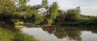
First, let's look at the Krasnodar region and the Kuban River, what do we see? We see a clear and rather sharp turn of the river, as a result, a sign of the presence of a washed out hole due to the current, which beats against the oncoming bank and creates a return, thereby, over a long period of existence, increasing the depth of the hole and the population of fish around it, which come here for food and, in principle, love places like this. Almost always such turns are a harbinger of good fishing or, on a bad day, at least a small but pleasant catch in the absence of a bite. Due to the limitation of viewing the number of GPS coordinate points, we see only two indicators with the greatest difference in depths - 4.2 and 4.4 meters, but they will be enough for us to roughly understand and outline the entire area of interest to us from the beginning of the entrance to the pit to the end of the exit pits, this is quite easy to do, I tried to depict it clearly in the picture.
An example of the depths and topography of a section of the Kuban River (Fig. No. 6)
Just two points with depth can indicate the appearance of two, almost identical rounded holes, we can only find out on the shore, by actually tapping the bottom, but such a turn of the river, its width, the duration of the coastline itself and almost identical depths in 90% of cases mean , that the current washed out the longitudinal hole along the entire turn, of course, I did not accurately depict the picture and could have been mistaken in one direction or another in determining the depth, but in general, I am sure that the picture is almost similar to reality.
In addition to all the advantages and prospects of this fishing spot in the bend, there is another, no less important indicator of the success of fishing here - an island literally 50 meters from the hole, turning into a spit and a small sandbank 10 meters long, as I wrote above, this is another the reason for the fishing success here. For a more understandable situation, in Figure No. 7 I tried to outline all the underwater currents available in this place, the arrows show all the directions of the flow and their changes, the formation of a return flow and a circular flow in a turn is also quite clearly visible, indicated by the arrow. Unfortunately, before saving the visualization, I made a small mistake and the image quality leaves much to be desired, but what is, that is, seems clear.
Formation of a reverse flow in a river bend (Fig. No. 7)
In general, I think the picture is more or less understandable and clear, let’s move on to another example.
The great and beautiful Volga River, not far from Volgograd, is the second example of supposedly reading the terrain before fishing according to minimally known indicators. In this case, the angle of rotation is more obtuse, but this does not at all prevent us from identifying a promising depression in the river, but only speaks about the elongation of the hole itself. As can be seen in Figure No. 8, we know 5-6 points by which we can determine to a greater extent the beginning of the entrance to the pit, the exit from the pit and its duration, however, the main channel of the river is also clearly visible. One of the features of lengthening such a section is small rifts located along its entire length with a shallower depth, usually the difference is about 10%, this is also clearly visible in the figure. This is primarily due to changes in the speed of the oncoming and reverse current, due to which the bottom is washed out less; for us fishermen, these places are the most significant and important due to the features of the stepped relief, which I also wrote about above.
An example of the depths and topography of a section of the Volga River (Fig. No. 
The article was written only for the Russian.Fishing fishing community, but you can share it even with the residents of Alaska, which has long slipped from their hands, like the fish of Alaska, I will be only too glad, good luck to everyone!
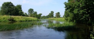
Fishing spots on the small river
There are plenty of promising places for fishing in the summer, even on a small river. Take a look at the photo and imagine how many small creatures fall into the water just with the growing row of greenery. Then why shouldn’t a fisherman set up a place for summer fishing here?
In fact, both banks of the small river in the summer are an inexhaustible source of fish food. But let the shallow water fishing grounds rich in food give away the fishermen on rivers with clear water.
But even here you can find places convenient for fishing without scaring away the fish. First of all, of interest in this regard are the differences in depth along the length of small rivers with indented banks, the boundaries of which can be easily determined by changes in the intensity of the current.