LiveInternetLiveInternet
Manych Driving along the Volgograd – Tikhoretsk road, near the city of Proletarsk you will cross Manych. The flat plain of the steppe, the slight rise of the Salsko-Manych ridge, will abruptly give way to a silvery water surface glistening in the sun. River? Lake? Reservoir? And this, and another, and a third. I was on Manych in two places in 2006. The left bank is south of the Proletarsky hydroelectric complex. On the right side is the Cheprak estuary, south of the village of Openki, east of the small village of Protoki. And in 2008 I visited the right northern shore of Lake Manych-Gudilo itself, in the area of the village of Manych. That is, I saw a very small part of this region, but I will try to tell you about the remaining part, at least partially.
In terms of the originality of its nature, the Manych depression has few equals in the world. Here you can find salty and fresh lakes, rivers with periodic water flow in two opposite directions, and nomadic lakes. The origin of this depression is tectonic, owing its existence to the Kuma-Manych trough. The trough is inherited from the basement fault zone separating the Karpinsky swell from the Stavropol arch, and its history can be traced from the beginning of the formation of the platform cover of the Scythian plate. The negative structure of the foundation was expressed in relief in the form of a lowland back in the Permian-Triassic (about 250 million years ago). In the Late Cretaceous, the structures were intensively submerged and covered by the sea. Having been revived, this trough again took shape as a relief structure in the middle and upper Pliocene, that is, 2 - 3 million years ago.
The Manych depression reaches its greatest height in its central part (approximately from the village of Divnoye to the village of Zunda Tolga), but this “highest level” is understood to be only 20-odd meters above sea level. On both sides of the watershed (to the northwest to the mouth of the Don and to the southeast to the lower reaches of the Kuma) the Manych Basin decreases, which is why it is divided into Western Manych, which belongs to the Azov Sea basin, and Eastern Manych, which belongs to the Caspian basin. In total, there were about 170 lakes in the Manych basin. Most were small - the area of 153 lakes was 5 square kilometers. The western part is richest in rivers and lakes; Lake Manych-Gudilo, or Bolshoy Liman, is located here, and the largest river of the basin, Western Manych, flows.
Until recently, there was a lot of uncertainty and mystery about this river. For a long time it was not possible to establish the location of its sources. Early researchers believed that Manych begins on a nearby hill and then spreads into two parts - western and eastern. Some even claimed that they reached this common source and swam from Western to Eastern Manych (which was later refuted). Academician K.M. Baer first pointed out in 1856 that Western and Eastern Manychi are independent systems and have no direct connection with each other. Here are his words (“Report on a trip to Manych”):
“In order to briefly outline the results that our small expedition achieved, and to show how the previous false concepts arose, it is necessary to distinguish between: the Manych lowland, the Manych valley itself and the bed of the Manych river. All these three concepts are expressed by the people in one word, Manych, and such and such a confusion gave rise to erroneous conclusions.
The Manych lowland is only sharply limited in its middle, namely in the north by the southern outskirts of the Ergeni Mountains, and in the south by the foothills of the Caucasus. The southern edge of the Ergeni Mountains has a much greater extent than is usually represented on maps. Their eastern tip, Cholon-Khamur, is at least 140 miles away from the western one. I myself could not form a clear view of how this southeastern extremity connects with the western one, while the descriptions of others are not quite definite, although most of them agree that Cholon-Khamur is the last and longest southeastern spur of these mountains We saw similar spurs, only smaller in size, much further to the north. It may be, however, that Cholon-Khamur constitutes a completely separate hill. On both sides, i.e. both from the north and from the south, this entire area noticeably decreases towards the Manych valley. To the east and west this area expands. It can be said that geologically the entire western coast of the Caspian Sea to the Caucasus and to the lower parts of the Volga belongs to it, although such vastness is not usually attributed to it. Toward the Sea of Azov, this lowland occupies, in addition to the seashore, another part of the land of the Don Cossacks.
The Manych valley is a sharply defined rut lying in this lowland, dividing east of Cholon-Khamur into two branches, of which the northern one goes to the east, and the southern one to the southeast. The first of these branches does not reach the Caspian Sea; its eastern end is either covered with loose sand or, perhaps, the inclination of the soil has undergone the greatest change here. It is possible, and even almost probable, that the northern branch, with its main direction to the east, was once considered by nomadic peoples to be a true continuation of Manych. On one of the maps stored in the local drawing room, this branch is called Mantz Ravine. Mantsa is the Kalmyk name for Manycha, and now nomadic peoples call it Ara-Mantsa. Moreover, it has high banks, like the middle part of the Manych valley before its division, which is not noticeable in the other branch. After this, it becomes clear why the other branch of the Manych valley received a completely different name - Sasty. Such a change in name would be difficult to explain if the second branch had always, like now, served as a drain for the water in the middle part of the Manych valley...
...From this brief description of the Manych valley, one can already form an idea of what the Manych River should be like. A river that, flowing near the Caspian Sea (80 or 120 versts from it) would flow all the way to the Don, as is depicted on all our maps, does not exist at all. Instead, from the western part of the Manych valley, a river actually flows, formed from the small rivers Ulan-Zukhi and Khara-Zukhi, originating from the Ergeni Mountains and containing water for a whole year; Moreover, in the spring, this same river has an influx of water from Shary-Khulsun, which lies almost at the highest point of its own valley, and through side ravines from the entire Manych lowland. On its further course, this river receives several more tributaries from the land of the Don Cossacks from the north, among other things the Krutinka, the sources of which are also located in the Ergeni Mountains, and from the south there are three Egorlykas. This river either expands in the form of lakes, occupying the entire width of the valley, then narrows and finally fits into the Don. It often happens that at the beginning of spring the valley is filled with snow water to its entire width, even in places where the river usually flows in a narrow channel. This was the case this year as well. Everything that has been said about the backwater of water in Manych due to the floods of the Don applies only to its western end.
Water also flows along the eastern, smaller half of the Manych valley, but only in spring and late autumn. Since it is not there even in winter, this temporarily flowing water cannot even be called a river. The eastern part of the Manych valley is rather a ravine, along which in spring and autumn water flows, often flooding the salt mud and khaki lying to the north of Lake Mazhar, partly pours into the Kuma lowland and sometimes, in combination with the water of the Kuma, flows into the Caspian Sea at its mouth, as it was last year, and probably this year. During a visit to this area by Mr. Cherkasov and land surveyors in the first half of May, water from Manych and Kuma had already flooded the post road and was close to the sea. But even if the water of the eastern part of the Manych valley did not reach the Caspian Sea with an open current, there is still no doubt that most of it would reach it by slow seepage through the sand. So, if they want to call this eastern flow a river, then it is necessary to distinguish two rivers in the Manych valley with completely opposite currents: the western one, flowing to the west, and the eastern one, flowing to the east. At the beginning of spring, both of these rivers are connected to each other in a rather strange way at their sources.”
However, he did not solve all of Manych’s riddles. Karl Behr believed that Western Manych begins from the watershed with the Caspian Sea (northeast of the village of Divnoye) with a small stream flowing into Lake Manych-Gudilo, passing through which it flows all the way to the Don. This judgment was also included in geography textbooks. However, in the 20th century, already during research on the problem of the Manych Canal under the leadership of A.F. Samokhin, it turned out something else. There is no continuous watercourse from the watershed between the Azov and Caspian Seas to the Don. The western part of the Manych Basin is divided into two parts: the upper closed region (from the watershed to the Bolshoy Egorlyk River), which has no flow into the sea, occupied by Lake Manych-Gudilo, and the lower one, from the Yegorlyk bed to the Don. We can say that Egorlyk, reaching Manych, turns sharply to the west and continues in the form of a river called Western Manych. Thus, we can say that the sources of Western Manych are located within the Stavropol Upland on Mount Strizhament, where Bolshoi Yegorlyk originates.
Lake Manych-Gudilo did not have a permanent connection with Yegorlyk, and, therefore, was not the source of Western Manych. There was no constant flow of water in the lake. Only in years of exceptionally large floods or very strong eastern surge winds could part of the water of Lake Manych-Gudilo overflow into the bed of Bolshoi Yegorlyk and Western Manych. In turn, in high-water years, Egorlyk could sometimes feed the lake through a ditch running from its mouth. In such cases, local residents said: “The water of Yegorlyk is going uphill” - a ditch slopes towards Yegorlyk.
The Kalaus River (like Yegorlyk), reaching the Manych depression, turns sharply to the east. It gives rise to Eastern Manych. At Kalaus and Yegorlyk, a rare phenomenon called “bifurcation” was observed - the division of the river into two branches directed into different water systems. In high-water years or after heavy rains, Kalaus discharges water in two directions: mainly to the east, but also to the west along a small channel towards Lake Manych-Gudilo.
Periodic changes in the direction of water flow in the area of the Manych depression are characteristic not only of these rivers, but also of a dozen other smaller ones that reach the Manych depression. In high-water years they flow both to the west and to the east; in low-water years they flow only in one direction, and in dry years they form drainless reservoirs.
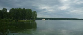
Lake Manych-Gudilo is one of the longest lakes in the country, its length reached 180 kilometers (which is comparable to Ladoga and Onega). The width, however, was “only” 10–12 kilometers.
On the northern side, narrow estuaries extending from west to east connect the lake. Among the low ridges, parallel to one another, lie similar salt lakes. Some are self-settling pools, meaning they form salt. One of these lakes is Lake Gruzskoye. At the eastern end there are the same subsidiary estuaries and separate salt lakes, the so-called Staro-Manotsky.
The upper reaches of the Western Manych, which has several branches and forms clear-shaped lakes, flows into the eastern end of the lake. These lakes and channels are called Podmanki. Even further to the east, the valley of Western Manych narrows, is overgrown with reeds and turns into a flat salt marsh. A small strip, overgrown with green grass in summer, separates the Kalaus valley from this salt marsh, which flows from the Stavropol Upland. Its current feeds the Eastern Manych, and during floods or heavy rains it floods the salt marsh and flows to the west.
To the north of Gudil there is a steppe with the already mentioned ridges, and at a distance of 10-15 kilometers there are quite high “mountains”, that is, the slope of the Salsko-Manych ridge or hill.
The northern shore of the lake is steep. The southern coast is flat, it is significantly lower than the northern one, the low steppe imperceptibly merges with the Stavropol steppes and was heavily flooded during high water. The huge expanse of the lake in the middle of the steppe made and still makes a majestic impression.
In the past, the lake caused surprise and some fear among local residents; many legends arose about it. They said that a mysterious hum was heard above it - hence the name. The hum occurs when large waves, rising in strong winds, are reflected from a steep shore. These sounds are joined by the howling of the wind in the ravines of the northern coast.
The size of the lake in the past experienced significant fluctuations. In some years the lake dried up almost completely. Cars drove along the dry and smooth bottom in 1926. In high-water years, on the contrary, the length and depth of the lake increased (in 1885 and 1922, for example, the depth reached 2.2 meters).
The rapid movements of water under the influence of the rush and surge of the wind, periodic fluctuations in the level and area of the lake apparently made an impression on the local residents, and they developed a well-known belief that at the bottom of the lake there are large abysses that from time to time absorb water, which is why there is an underwater hum. According to legends, the water of the lake went underground into the Caspian Sea.
The relict lake is located on salt-bearing clays, so its water is highly mineralized. When the lake dries out, the salinity of the water increases and exceeds the salinity of sea water. There were no fish in the lake before. The name “Manych” itself is the Tatar word for “salty” or “bitter”.
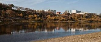
Now the lake is replenished with water supplied through the Kuban-Egorlyk Canal. It was planned that the water would desalinize, salt efflorescence would disappear, and the lifeless landscape of the banks would change. Judging by the map, a significant part of Manych-Gudil remained salty. But the desalinization was enough for masses of migratory birds to make temporary stops at Manych. The lake today is part of the Proletarsky reservoir, formed by the construction of a dam near the city of Proletarsk (former village of Velikoknyazheskaya) in 1939-1941. At the same time, another reservoir was created on the Manych River, Veselovskoye. At the same time, the Western Manych River practically disappeared under the waters of reservoirs.
Manych repeatedly became a sea strait connecting the Caspian and Black Seas, and for the first time in science this assumption was voiced by Academician Pallas based on the results of academic expeditions of 1768-1774. The system of straits connecting the Caspian and Black Sea basins, which included the 600-kilometer-long Manych Strait, is unique in the geological history of the planet. In the Pleistocene (the last 700 thousand years of the Earth’s history, or in the Neopleistocene, if we divide the Pleistocene into the Eopleistocene and Neopleistocene), this connection occurred, for example, during the Baku (about 450 - 400 thousand years ago), early Khazar (about 300 - 200 thousand years ago) transgressions of the Caspian Sea. From the Black Sea, waters flooded the Manych Strait during the Karangat transgression in the range of 120 - 80 thousand years ago; periodically then the waters were discharged into the Caspian Sea. The last time the strait existed was 15-12 thousand years ago, during the period of the Early Khvalynsk, the largest transgression of the Caspian Sea in the Neopleistocene. The sea, which had risen 80 meters from its current position, overflowed the Manychsky threshold near the village of Zunda Tolga. The width of the Manych Strait reached 40 kilometers. The strait was an insurmountable obstacle to the movement of fauna and made it difficult for flora to move from north to south, towards the Caucasus. The fall of the riverbed - 0.2 meters per kilometer is close (for some, even more) to the fall of the large lowland rivers of Russia. The Manych Strait was a very wide, majestic river. The system of modern reservoirs in this sense makes it possible to look into the past and imagine what Manych looked like then.
Traces of the activity of the last active strait can be seen most clearly in the relief. Let's talk about this in more detail. After the cessation of connection in the Khazar age, the vast Burtas Lake was formed between the Sal and Zunda-Tolga uplifts. Its Burtas or Gudilov layers form an unusually thick (up to 35 meters) thickness of clay. The thickness is composed of sediments that were brought into the Manych basin by the Kalaus, Bolshoy Yegorlyk and other tributaries. The long time interval in which Lake Burtas existed and was filled with sediments ranges from approximately 80 to 30 thousand years ago.
The growth of the Zunda-Tolga uplift, or threshold, which acted as a dam, was the reason for the high level of the Caspian Sea during the subsequent Early Khvalynian transgression. When the level of the rising Early Khvalynian basin of the Caspian Sea reached the surface level of Lake Burtas, already filled with sediments, 40-45 meters above sea level, the flow of Caspian waters began. The runoff was accompanied by enormous erosion, first deep and then lateral. There was an erosion of the Burtas or Gudilovsky clay massif. In the upper reaches of Western Manych and especially in the Manych-Gudilovsky expansion, the river-strait valley split into several, four or five, channels that eroded deep, up to 35 meters, hollows, separated by ridges-ridges, elongated in the direction of the drainage. It was a rather lengthy process, by no means a catastrophic one. Now these ridged ridges, 5-10 km long, 0.5-2 km wide at the base, separated by hollows and salt lakes, are directly visible evidence of the action of the waters of the former connection of the seas. For a long time the ridges were described as Baer mounds, but their origin, apparently, is different.
The idea of the existence of a strait arises here, probably, as obvious, by itself. V.V. Bogachev, in his article “The Manych Problem,” published in 1936, makes an interesting observation. He writes that in all centuries the population of the Trans-Don steppes has preserved the legend about the once existing waterway from the Sea of Azov and the Don to the Caspian Sea. Don foreman Andrei Martynov (perhaps the first colonizer of the Manych steppes, who founded the settlement, which later became the village of Velikoknyazheskaya, and then the city of Proletarskoe), left notes dating back to the end of the 18th century, where indications of Arab sources talking about this were preserved. On Lake Gudile itself, stories are constantly preserved about the wreckage of large ships thrown out during strong storms. Bogachev notes that these stories are not particularly reliable, but what is important here is the impression that Manych made on those who know how to observe and think about what they saw.
The valley of the Manych River is a zone of lost archaeological sites. In the 1930s, during the construction of a cascade of reservoirs, a huge number of archaeological sites were destroyed. Archaeological research during the construction of the reservoirs was minimal. Many remains of nomads and settlements indicate that there was enough fresh water for both animals and people. It was enough until the next waves of settlers arrived, who also needed water...
Without delving into the detailed history of the tribes that lived on the banks of the Manych from the Neolithic to the present day, it should be noted that such a river is a natural zone of attraction for any nomadic and especially sedentary groups in the steppe. Now Manych is considered as one of the main transport and trade arteries of the Khazar Kaganate (apparently, the Khazars called Manych “Ug-ru”), connecting the North Caucasus with the lower Don and the Azov region. Of course, not a water artery, but a path along which you can move on dry land - but without moving away from the water.
In 2008, I got to Manych through the village of Volochaevsky and further to the village of Manych. The road went into the Manych valley, leaving its ancient banks on the left - now in the relief they are visible in the form of the heights of the Salsko-Manych ridge. Apparently, it was the hills of the Salsko-Manych ridge that medieval Arab authors mentioned as the “Khazar Mountains”... After Volochaevsky, the road either sank to the bottom of dry eriks, then again rose to low hills stretched parallel to Manych.
The village of Manych is located near a lake called Gruzskoe. It is dry and filled with either salty mud or dirty salt. Going around the lake on the left, the road forks. In one direction it goes to Kalmykia, in the other it leads to the shore of Manych-Gudila past the hydrometeorological station.
I was standing on the shore, at the edge of the cliff, taking photographs, when my father, who was a little behind, suddenly called out to me. Rushing loudly in the dry grass, a two-meter light-colored snake made its way to the cliff, almost directly towards me. I had to practically jump to the side. The snake slid off the edge and slowly disappeared into some crack in the cliff.
This is a yellow-bellied snake. They just reach this size and have a similar color. As the reference book writes, this is one of the most evil and aggressive (but not poisonous) snakes of our fauna. When meeting a person, he often does not even try to hide, but takes a threatening pose and, with a loud hiss, opening his mouth, rushes at the enemy, sometimes with jumps up to a meter long. The snake is brave - I was convinced of this. I had to give way to it. Maybe, it turns out, eat a viper on occasion. In the south in the steppes they are not uncommon, but this was the first time I had seen such a large snake. Manych-Gudilo The largest lake in the Rostov region, Manych-Gudilo, is a relict, tectonic, so-called saucer lake. The length of the lake is more than 150 km in length, and up to 10-15 km (in some places) in width; its depth is 4 m or more. Along the shores of the lake, the reserve borders Kalmykia, the Stavropol Territory, and the Proletarsky District of the Rostov Region. Lake Manych-Gudilo, with water whose salinity is almost twice that of the Black Sea, is one of the largest lakes in Europe. Here you can find small - southern - and three-spined smelt, needle fish - that’s all, perhaps, that can live in such salty water.
The harsh beauty of Lake Manych-Gudilo, the contrast and partly unpredictability of the natural phenomena occurring in it, and the poor knowledge of many of them gave rise to legends, fairy tales, and tales among the people who lived in the vicinity.
The strong winds prevailing in these places raise large waves on the lake, which noisily hit the shores, in some places their height reaches 12-15 meters or more. Their roar spreads far across the surrounding area. The howl of the wind over the steep banks, in numerous gullies and ravines complements this humming range of sounds, which gave the name to the lake - Gudilo. The hum can be heard in one or another part of the lake even in calm weather.
In the center of the lake is Vodny Island, where a herd of feral horses has lived for more than 50 years. The free herd is one of the attractions of the Rostovsky State Nature Reserve. Nobody knows how and when horses got to Vodny Island.
The island, 12 km long and up to 4 km wide, has sheltered new settlers; there is only no fresh water here. Therefore, watering horses in the summer, when the air temperature reaches +30 – +40 degrees, is carried out by the staff of the reserve. Thanks to the care of the reserve’s staff, the number of horses in the herd today is more than 300.
A 10-minute walk along the shore of this island reveals another small island - “Bird”. Its length is 100 m, width up to 20 meters. Here we can already see reeds, which indicates the presence of fresh springs on the island. The following nesting places on the island include: spoonbills, laughing gulls, little egrets, mute swans, sometimes Dalmatian pelican, etc.
Guided by the memory of hundreds and thousands of generations, countless flocks of birds annually accumulate on reservoirs, islands and the shores of Manych lakes. That is why, as a main flight route and a place for seasonal gatherings of waterfowl and semi-aquatic birds, Lake Manych-Gudilo is included in the list of objects of the international Ramsar Convention on the Protection of Wetlands, and the Island section of the reserve is recognized as a key ornithological area of international importance.
The “Starikovsky” section of the reserve is located in the east of the Oryol region and has an area of 2182.5 hectares.
A special feature of its territory is a large number of ravines. Along the slopes of the Lisya and Starikov beams, crystalline veins of gypsum emerge to the surface. Individual crystalline aggregates reach large sizes and weights of up to several kilograms. As in a geological museum, you can find here crystal intergrowths in the form of a “rose” and a “swallowtail”. There are white outcrops of salt along the bottoms of the gullies, and many watercourses are highly mineralized. Along salt-water streams and along the bottoms of gullies, a unique vegetation of saline soils has developed. Saltweed, saltwort, sarsazan and other salt-tolerant plants grow. At the beginning of summer, the thickets of saltworts look like bright green lawns of lush vegetation. With the approach of autumn frosts, anthocyanin pigment is formed in their tissues, giving the stems a red color. Among the burnt-out autumn steppe, lawns and streambeds of ravines covered with saltwort look very unusual.
Also in this territory, feather grasses are noted: Lessinga, Ukrainian, hairy, dry-steppe sage, etc.; meadow vegetation is well represented with the participation of Gerard's rush, ground reed grass, Gmelin's kermek and Sarepta kermek, creeping wheatgrass, black-sedge, etc.
On the Starikovsky site there is the Lysyansky pond - a huge fresh reservoir created by human hands. It is appreciated by the bird world. Here you can meet swans, majestically and sedately swimming in clear waters, coots, shelducks, geese, grebes and many other birds.
Demoiselle cranes gather in large numbers near the ponds. On some days, concentrations of up to three thousand of these birds were recorded here at the same time. There are few places in Russia where you can see demoiselle cranes in such large numbers, which is why this bird has become a symbol of the reserve. Vegetation near the reservoir is represented by reeds, reeds, cattails, and sedges. Tumbleweed plants have an interesting and unique form.
The “Krasnopartisan” site is located 5 km southeast of the “Starikovsky” site in the Remontnensky district and covers 1,768 hectares.
Along the borders of this area there are forest belts where rooks, falcons, and kestrels have found their permanent place of residence. The steppes of this part of the reserve are known as a gathering place for flocks of little bustards on autumn migrations.
The Krasnopartizansky site is a typical fescue-feather grass steppe, the predominant vegetation of which is represented by perennial drought- and frost-resistant plants with a powerful root system. These are feather grass, fescue, sage, wheatgrass, yarrow and other herbs.
The Tsagan-Khag site is located in the south of the Remontnensky district. Its area is 990 hectares. This mysterious name of the site, translated from Kalmyk, means “white silt”: the lake, located on a saline area, periodically dries up, then white salt appears on the surface, which gave the name to the reserved lake.
The site is located on the territory of two subjects of the Federation: the western part - the Proletarskoye Reservoir - in the Rostov region, the eastern part - Lake Manych-Gudilo - in the Republic of Kalmykia, within the ornithological branch of the state reserve "Black Lands". The western border of the site is located 160 km southeast of the city of Rostov-on-Don, the eastern border is 80 km west-southwest of the city of Elista. The Proletarskoye Reservoir is a large body of water with a labyrinth of estuaries and shallow bays on the northern coast. Reed thickets typical for the zone are developed only in desalinated areas in the ravines and near the Novo-Manych dam. Place of nesting, molting, feeding during migration of Anseriformes, waders, herons, ibis and copepods. Area of concentration of migrating geese, ducks and waders. On the lake Due to the high salinity of the waters, Manych-Gudilo surface vegetation is almost undeveloped, and numerous islands of the reservoir are covered with grass and forb associations. The productivity of zooplankton and benthos is very high. A place of mass nesting of colonial waterbirds: gulls, pelicans, wavy birds. An area of mass flight and stopover during the migration period of waterfowl and semi-aquatic birds, one of the largest concentrations of migrating geese in Eurasia (white-fronted goose, red-breasted goose, lesser lesser white-fronted goose, greylag goose). Ornithological research was carried out at the Manych station of the Southern Scientific Center of the Russian Academy of Sciences. The most numerous and diverse avifauna is confined to near-water habitats. The most representative species in this area are the great grebe Podiceps cristatus, Dalmatian pelican Pelecanus crispus, Dalmatian pelican Pelecanus onocrotalus, mute swan Cygnus olor, mallard Anas platyrhynchos, gray crane Grus grus, coot Fulica atra, lapwing Vanellus vanellus, turukhat Philomachus pugnax, moor squirrel Himantopus himantopus , Black-headed Gull Larus melanocephalus, Black-headed Gull Larus ridibundus, Laughing Gull Larus cachinans, Black-headed Gull Hydroprogne caspia, Common Tern Sterna hyrundo, Sand Martin Riparia riparia. Less numerous are the black-necked grebe Podiceps nigricollis, the great cormorant Phalocrocorax carbo, the bittern Botaurus stellaris, the little bittern Ixobrychus minutus, the night heron Nycticorax nycticorax, the great egret Egretta alba, the little egret Egretta garzetta, the little egret Plegadis falcinellus, the greylag goose Anser anser, Tadorna ferruginea, Shelduck Tadorna tadorna, Marsh Harrier Circus aeruginosus, Little Plover Charadrius dubius, Great Curlew Numenius arquata, Avocet Recurvirostra avosetta, Oystercatcher Haematopus ostralegus, Black-headed Gull Larus ichtyaetus, Little Gull Larus minutus, Eagle Owl Bubo bubo, Roller Coracia s garullus.
The following bird species were recorded for the steppe areas: white-tailed eagle Haliaeetus albicilla, hen harrier Circus cyaneus, long-legged buzzard Buteo rufinus, buzzard Buteo buteo, steppe eagle Aquila nipalensis, black kite Milvus migrans, black vulture Aegypyus monachus, griffon vulture Gyps fulvus, falcon Falco vespertinus, common kestrel Falco tinnunculus, gray partridge Perdix perdix, common crane Grus grus, demoiselle Anthropoides virgo, little bustard Tetrax tetrax, steppe lark Melanocorypha calandra.
In many settlements and their environs there are ringed doves Streptopelia decaocto common, house owl Athene noctua, bee-eater Merops apiaster, hoopoe Upupa epops, barn swallow Hirundo rustica, roseate starling Sturnus roseus.
Used literature: V.G. Gnilovskaya. Entertaining local history. Stavropol book publishing house. 1954 Popov G.I. Pleistocene of the Black Sea-Caspian Straits. 1983 Bogachev V.V. Manych's problem. Proceedings of Azerbaijan. NIINI, vol. 31. 1936 Words from Baer from “Report on the trip to Manych” // Bulletin of the Geographical Society, 1856, vol. 18. No. 2, cited from the book: Volosukhin V.A., Melnikov V.V. Channel Eurasia and Volgo-Don-2: past, present, future.
Steppe Pathfinder 2008 - 2011
Based on materials from the sites: https://dontourism.ru/ https://www.stepnoy-sledopyt.narod.ru/manych/manych.htm https://tourism-proletarsk.land.ru/fishing.html
Bite forecast
White amur
52
Average bite of grass carp White carp is found in deep places
42
Grass carp bite is worse than average Grass carp is found in deep places
42
Grass carp bite is worse than average Grass carp is found in deep places
52
Average bite of grass carp White carp is found in deep places
52
Average bite of grass carp White carp is found in deep places
42
Grass carp bite is worse than average Grass carp is found in deep places
42
Grass carp bite is worse than average Grass carp is found in deep places
52
Average bite of grass carp White carp is found in deep places
56
Average bite of grass carp White carp is found in deep places
45
Grass carp bite is worse than average Grass carp is found in deep places
45
Grass carp bite is worse than average Grass carp is found in deep places
56
Average bite of grass carp White carp is found in deep places
57
Average bite of grass carp White carp is found in deep places
46
Grass carp bite is worse than average Grass carp is found in deep places
46
Grass carp bite is worse than average Grass carp is found in deep places
57
Average bite of grass carp White carp is found in deep places
Loach
48
The loach bite is worse than average The loach is found in deep places
48
The loach bite is worse than average The loach is found in deep places
57
Average loach bite The loach is found in deep places
68
The loach bites quite well. The loach is found in deep places
48
The loach bite is worse than average The loach is found in deep places
43
The loach bite is worse than average The loach is found in deep places
43
The loach bite is worse than average The loach is found in deep places
48
The loach bite is worse than average The loach is found in deep places
36
Sluggish biting of the loach The loach is found in deep places
46
The loach bite is worse than average The loach is found in deep places
36
Sluggish biting of the loach The loach is found in deep places
51
Average loach bite The loach is found in deep places
47
The loach bite is worse than average The loach is found in deep places
53
Average loach bite The loach is found in deep places
53
Average loach bite The loach is found in deep places
75
Good loach bite The loach is found in deep places
Chub
41
The chub bite is worse than average. The chub is found in deep places.
74
Good chub bite The chub is found in deep places
98
Excellent chub bite Chub is found in deep places
82
Very good chub bite The chub is found in deep places
44
The chub bite is worse than average. The chub is found in deep places.
70
Good chub bite The chub is found in deep places
78
Good chub bite The chub is found in deep places
61
Good chub bite The chub is found in deep places
33
Sluggish chub bite The chub is found in deep places
75
Good chub bite The chub is found in deep places
65
Good chub bite The chub is found in deep places
65
Good chub bite The chub is found in deep places
43
The chub bite is worse than average. The chub is found in deep places.
85
Very good chub bite The chub is found in deep places
95
Excellent chub bite Chub is found in deep places
95
Excellent chub bite Chub is found in deep places
Minnow
58
Average minnow bite The minnow is found in deep places
89
Very good minnow bite The minnow is located at shallow depths
100
The best bite for minnows Minnows are found in deep places
89
Very good minnow bite The minnow is located at shallow depths
62
Good bite for minnows Minnows are found in deep places
88
Very good minnow bite The minnow is located at shallow depths
95
Excellent bite for minnows. Minnows are found in deep places.
69
Good bite for minnows. Minnows are located at shallow depths.
46
The minnow bite is worse than average. The minnow is found in deep places.
94
Excellent bite for minnows. Minnows are located at shallow depths.
79
Good minnow bite Minnow is found in deep places
73
Good minnow bite The minnow is located at shallow depths
61
Good bite for minnows Minnows are found in deep places
100
The best bite for a minnow The minnow is located at shallow depths
100
The best bite for minnows Minnows are found in deep places
100
The best bite for a minnow The minnow is located at shallow depths
Gorchak
0
There is no bite for the bitterling. The bitterling is found in deep places.
82
Gorchak bite is very good Gorchak is found in deep places
81
Gorchak bite is very good Gorchak is found in deep places
75
Gorchak has a good bite Gorchak is found in deep places
0
There is no bite for the bitterling. The bitterling is found in deep places.
78
Gorchak has a good bite Gorchak is found in deep places
64
Gorchak has a good bite Gorchak is found in deep places
55
The average bite of bitterling Gorchak is in deep places
0
There is no bite for the bitterling. The bitterling is found in deep places.
83
Gorchak bite is very good Gorchak is found in deep places
53
The average bite of bitterling Gorchak is in deep places
59
The average bite of bitterling Gorchak is in deep places
0
There is no bite for the bitterling. The bitterling is found in deep places.
94
Gorchak has an excellent bite Gorchak is found in deep places
77
Gorchak has a good bite Gorchak is found in deep places
86
Gorchak bite is very good Gorchak is found in deep places
Dace
84
Very good bite for dace Dace is located at shallow depths
84
Very good bite for dace Dace is located at shallow depths
100
The best bite for dace Dace is located at shallow depths
84
Very good bite for dace Dace is located at shallow depths
93
Excellent bite for dace Dace is found in deep places
84
Very good bite for dace. Dace is found in deep places.
84
Very good bite for dace. Dace is found in deep places.
65
Good bite for dace. Dace is found in deep places.
70
Good bite for dace. Dace is found in deep places.
90
Very good bite for dace. Dace is found in deep places.
70
Good bite for dace. Dace is found in deep places.
70
Good bite for dace. Dace is found in deep places.
95
Excellent bite for dace Dace is located at shallow depths
100
The best bite for dace Dace is in deep places
100
The best bite for dace Dace is in deep places
100
The best bite for dace Dace is in deep places
crucian carp
51
Average bite for crucian carp Crucian carp is found in deep places
66
A good bite for crucian carp. Crucian carp is found in deep places.
88
Very good bite for crucian carp. Crucian carp is found in deep places.
77
Good bite for crucian carp. Crucian carp is located at shallow depths.
54
Average bite for crucian carp Crucian carp is found in deep places
63
A good bite for crucian carp. Crucian carp is found in deep places.
69
A good bite for crucian carp. Crucian carp is found in deep places.
60
Average bite of crucian carp Crucian carp is located at shallow depths
40
Sluggish bite of crucian carp Crucian carp is found in deep places
67
A good bite for crucian carp. Crucian carp is found in deep places.
58
Average bite for crucian carp Crucian carp is found in deep places
63
Good bite for crucian carp. Crucian carp is located at shallow depths.
53
Average bite for crucian carp Crucian carp is found in deep places
76
Good bite for crucian carp. Crucian carp is found in deep places.
84
Very good bite for crucian carp. Crucian carp is found in deep places.
93
Excellent bite for crucian carp. Crucian carp is located at shallow depths.
Carp
64
Good bite for carp Carp are found in deep places
64
Good bite for carp Carp are found in deep places
77
Good carp bite Carp are found in deep places
64
Good bite for carp Carp are found in deep places
66
Good bite for carp Carp are found in deep places
60
Average carp bite Carp are found in deep places
60
Average carp bite Carp are found in deep places
47
Carp bite is worse than average Carp are found in deep places
50
Carp bite is worse than average Carp are found in deep places
64
Good bite for carp Carp are found in deep places
50
Carp bite is worse than average Carp are found in deep places
50
Carp bite is worse than average Carp are found in deep places
65
Good bite for carp Carp are found in deep places
72
Good carp bite Carp are found in deep places
72
Good carp bite Carp are found in deep places
72
Good carp bite Carp are found in deep places
Rudd
45
The rudd bite is worse than average. The rudd is located at shallow depths.
74
Good rudd bite The rudd is found in deep places
99
Excellent rudd bite The rudd is found in deep places
83
Very good rudd bite The rudd is found in deep places
49
The rudd bite is worse than average. The rudd is located at shallow depths.
72
Good rudd bite The rudd is found in deep places
79
Good rudd bite The rudd is found in deep places
62
Good bite for rudd The rudd is found in deep places
37
Sluggish bite of rudd The rudd is located at shallow depths
76
Good rudd bite The rudd is found in deep places
66
Good bite for rudd The rudd is found in deep places
66
Good bite for rudd The rudd is found in deep places
50
The rudd bite is worse than average. The rudd is located at shallow depths.
87
Very good rudd bite The rudd is found in deep places
96
Excellent rudd bite The rudd is found in deep places
96
Excellent rudd bite The rudd is found in deep places
Bream
69
Good bite for bream Bream is found in deep places
77
Good bream bite Bream is found in deep places
92
Excellent bream bite Bream is found in deep places
86
Very good bream bite Bream is found in deep places
73
Good bream bite Bream is found in deep places
74
Good bream bite Bream is found in deep places
74
Good bream bite Bream is found in deep places
64
Good bite for bream Bream is found in deep places
55
Average bream bite Bream is found in deep places
79
Good bream bite Bream is found in deep places
61
Good bite for bream Bream is found in deep places
68
Good bite for bream Bream is found in deep places
72
Good bream bite Bream is found in deep places
90
Very good bream bite Bream is found in deep places
90
Very good bream bite Bream is found in deep places
100
The best bite for bream Bream is found in deep places
Tench
51
Average tench bite Tench is found in deep places
51
Average tench bite Tench is found in deep places
61
Good tench bite Tench is found in deep places
63
Good tench bite Tench is found in deep places
51
Average tench bite Tench is found in deep places
46
Tench bite is worse than average Tench is found in deep places
46
Tench bite is worse than average Tench is found in deep places
45
Tench bite is worse than average Tench is found in deep places
38
Sluggish tench bite Tench is found in deep places
49
Tench bite is worse than average Tench is found in deep places
38
Sluggish tench bite Tench is found in deep places
48
Tench bite is worse than average Tench is found in deep places
50
Tench bite is worse than average Tench is found in deep places
56
Average tench bite Tench is found in deep places
56
Average tench bite Tench is found in deep places
70
Good tench bite Tench is found in deep places
lake trout
74
Good bite for lake trout Lake trout are located at shallow depths
74
Good bite for lake trout Lake trout are located at shallow depths
88
Very good bite for lake trout Lake trout are located at shallow depths
74
Good bite for lake trout Lake trout are located at shallow depths
81
Very good bite for lake trout Lake trout are located at shallow depths
73
Good bite for lake trout Lake trout are located at shallow depths
73
Good bite for lake trout Lake trout are located at shallow depths
57
Average lake trout bite Lake trout are located at shallow depths
61
Good bite for lake trout Lake trout are located at shallow depths
78
Good bite for lake trout Lake trout are located at shallow depths
61
Good bite for lake trout Lake trout are located at shallow depths
61
Good bite for lake trout Lake trout are located at shallow depths
76
Good bite for lake trout Lake trout are located at shallow depths
88
Very good bite for lake trout Lake trout are located at shallow depths
88
Very good bite for lake trout Lake trout are located at shallow depths
88
Very good bite for lake trout Lake trout are located at shallow depths
Perch
0
No perch biting Perch is in deep places
81
Very good perch bite. Perch is found in deep places.
81
Very good perch bite. Perch is found in deep places.
74
Good perch bite Perch is found in deep places
0
No perch biting Perch is in deep places
70
Good perch bite Perch is found in deep places
70
Good perch bite Perch is found in deep places
50
The perch bite is worse than average. The perch is in deep places.
0
No perch biting Perch is in deep places
66
Good perch bite Perch is found in deep places
58
Average perch bite Perch is found in deep places
46
The perch bite is worse than average. The perch is in deep places.
0
No perch biting Perch is in deep places
74
Good perch bite Perch is found in deep places
74
Good perch bite Perch is found in deep places
67
Good perch bite Perch is found in deep places
Roach
55
Average roach bite Roach is found in deep places
79
Good roach bite Roach is found in deep places
95
Excellent roach bite Roach is found in deep places
79
Good roach bite Roach is found in deep places
60
Average roach bite Roach is found in deep places
77
Good roach bite Roach is found in deep places
77
Good roach bite Roach is found in deep places
60
Average roach bite Roach is found in deep places
44
Roach bite is worse than average Roach is found in deep places
82
Very good roach bite Roach is found in deep places
63
Good roach bite Roach is found in deep places
63
Good roach bite Roach is found in deep places
58
Average roach bite Roach is found in deep places
93
Excellent roach bite Roach is found in deep places
93
Excellent roach bite Roach is found in deep places
93
Excellent roach bite Roach is found in deep places
Podust
51
Average bite of the Podust The Podust is located at a shallow depth
100
The best bite for underdust The underdust is located at shallow depths
100
Podust has the best bite. Podust is found in deep places.
100
The best bite for underdust The underdust is located at shallow depths
56
Average bite of the Podust The Podust is located at a shallow depth
100
The best bite for underdust The underdust is located at shallow depths
94
Excellent bite for Podust Podust is found in deep places
78
Good bite of the underdust The underdust is located at a shallow depth
42
Podust bite is worse than average Podust is located at shallow depths
100
The best bite for underdust The underdust is located at shallow depths
78
Podust has a good bite. Podust is found in deep places.
84
Very good bite of the underdust The underdust is located at a shallow depth
53
Average bite of the Podust The Podust is located at a shallow depth
100
Podust has the best bite. Podust is found in deep places.
100
Podust has the best bite. Podust is found in deep places.
100
Podust has the best bite. Podust is found in deep places.
Rotan
53
Average bite of rotan Rotan is found in deep places
53
Average bite of rotan Rotan is found in deep places
53
Average bite of rotan Rotan is found in deep places
53
Average bite of rotan Rotan is found in deep places
58
Average bite of rotan Rotan is found in deep places
46
Rotan bite is worse than average Rotan is found in deep places
46
Rotan bite is worse than average Rotan is found in deep places
36
Sluggish bite of rotan rotan is found in deep places
39
Sluggish bite of rotan rotan is found in deep places
44
Rotan bite is worse than average Rotan is found in deep places
39
Sluggish bite of rotan rotan is found in deep places
34
Sluggish bite of rotan rotan is found in deep places
39
Sluggish bite of rotan rotan is found in deep places
49
Rotan bite is worse than average Rotan is found in deep places
49
Rotan bite is worse than average Rotan is found in deep places
49
Rotan bite is worse than average Rotan is found in deep places
Zander
79
Good bite for pike perch Pike perch is found in deep places
79
Good bite for pike perch Pike perch is found in deep places
79
Good bite for pike perch Pike perch is found in deep places
79
Good bite for pike perch Pike perch is found in deep places
84
Very good bite for pike perch Pike perch is found in deep places
67
Good bite for pike perch Pike perch is found in deep places
67
Good bite for pike perch Pike perch is found in deep places
52
Average pike perch bite Pike perch is found in deep places
56
Average pike perch bite Pike perch is found in deep places
64
Good bite for pike perch Pike perch is found in deep places
56
Average pike perch bite Pike perch is found in deep places
49
The pike perch bite is worse than average. Pike perch is found in deep places
57
Average pike perch bite Pike perch is found in deep places
71
Good bite for pike perch Pike perch is found in deep places
71
Good bite for pike perch Pike perch is found in deep places
71
Good bite for pike perch Pike perch is found in deep places
Bleak
76
Good bleak bite Bleak is found in deep places
76
Good bleak bite Bleak is found in deep places
91
Excellent bleak bite Bleak is found in deep places
76
Good bleak bite Bleak is found in deep places
79
Good bleak bite Bleak is found in deep places
71
Good bleak bite Bleak is found in deep places
71
Good bleak bite Bleak is found in deep places
55
Average bleak bite Bleak is found in deep places
59
Average bleak bite Bleak is found in deep places
75
Good bleak bite Bleak is found in deep places
59
Average bleak bite Bleak is found in deep places
59
Average bleak bite Bleak is found in deep places
77
Good bleak bite Bleak is found in deep places
86
Very good bleak bite. Bleak is found in deep places.
86
Very good bleak bite. Bleak is found in deep places.
86
Very good bleak bite. Bleak is found in deep places.
Pike
0
No pike biting Pike are in deep places
93
Excellent pike bite Pike are found in deep places
92
Excellent pike bite Pike is located at shallow depths
92
Excellent pike bite Pike is located at shallow depths
0
No pike biting Pike are in deep places
86
Very good pike bite Pike are found in deep places
81
Very good pike bite Pike is located at shallow depths
63
Good pike bite Pike is located at shallow depths
0
No pike biting Pike are in deep places
82
Very good pike bite Pike are found in deep places
67
Good pike bite Pike is located at shallow depths
59
Average pike bite Pike is located at shallow depths
0
No pike biting Pike are in deep places
91
Excellent pike bite Pike are found in deep places
86
Very good pike bite Pike is located at shallow depths
86
Very good pike bite Pike is located at shallow depths
Ide
62
Good bite for ide. Ide is found in deep places.
88
Very good bite of ide. Ide is found in deep places.
100
The best bite for ide. Ide is found in deep places.
88
Very good bite of ide. Ide is found in deep places.
67
Good bite for ide. Ide is located at shallow depths.
85
Very good bite of ide. Ide is located at shallow depths.
85
Very good bite of ide. Ide is located at shallow depths.
67
Good bite for ide. Ide is located at shallow depths.
50
The ide bite is worse than average. The ide is located at shallow depths.
91
Excellent bite of ide. Ide is located at shallow depths.
71
Good bite for ide. Ide is located at shallow depths.
71
Good bite for ide. Ide is located at shallow depths.
68
Good bite for ide. Ide is located at shallow depths.
100
The best bite for ide. Ide is found in deep places.
100
The best bite for ide. Ide is found in deep places.
100
The best bite for ide. Ide is found in deep places.
Ruff
77
Good bite for ruff The ruff is located at a shallow depth
77
Good bite for ruff The ruff is located at a shallow depth
72
Good bite for ruff Ruff is found in deep places
77
Good bite for ruff The ruff is located at a shallow depth
85
Very good bite of the ruff The ruff is located at a shallow depth
68
Good bite for ruff The ruff is located at a shallow depth
65
Good bite for ruff Ruff is found in deep places
53
The average bite of the ruffe The ruff is located at a shallow depth
57
The average bite of the ruffe The ruff is located at a shallow depth
65
Good bite for ruff The ruff is located at a shallow depth
53
The average bite of the ruff Ruff is in deep places
50
The ruff bite is worse than average. The ruff is located at a shallow depth
56
The average bite of the ruffe The ruff is located at a shallow depth
72
Good bite for ruff The ruff is located at a shallow depth
68
Good bite for ruff Ruff is found in deep places
72
Good bite for ruff The ruff is located at a shallow depth
Add:
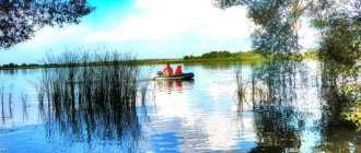
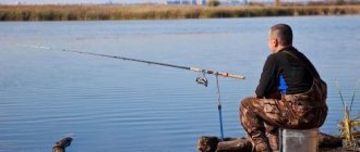
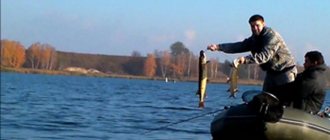
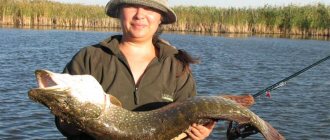
Fishing on Lake Manych-Gudilo
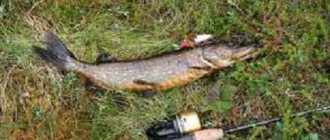
The water in Lake Manych-Gudilo is salty, so there is no fish here. They fish mainly in the reservoir, where there is fresh water, or on the Manych River. Various types of fish live there: ruff, carp, crucian carp, pike perch, carp and others. You can fish both from the shore and by boat.
Some fishing lovers come here for several days to not only enjoy their favorite activity, but also the nature around them.
© Magdalena happiness