Published: 12/29/2019 Category: Author's essay
The Lovat River forms a narrow plain, which in the Novgorod region very smoothly levels out with the Ilmen lowland. During the entire journey the floodplain goes down very smoothly. Only in the middle section there is a sharp difference in heights (several dozen thresholds). From time immemorial, the water artery connected northern Polesie with Novgorod Land. That is, it was strategic. And therefore she left many reminders of herself in historical documents. Today it is an attractive recreational area for us.
general description
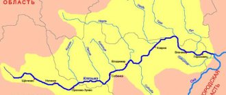
The Lovat River is 530 km long. Its pool is 21,900 sq. km. Maximum width 2,700 m (Vorokhobskoe extension). Depths up to 6 meters (in the area of whirlpools). The reservoir flows through the Vitebsk region of Belarus, as well as through the Pskov and Novgorod regions of the Russian Federation. The slope is average. North direction. The average long-term water consumption is 169 cubic meters per second. Mixed feeding (rain and snow). Freeze-up lasts from late November to mid-March. The flood occurs in March - April. Steep bends (Velikie Luki) are characterized by ice jams. The channel has several large lakes inside. The seasonal range of changes in water level is very high. There are about a hundred Lovat branches (including streams). Large tributaries are the Nasva, Kunya, Loknya, Redya, Polist and Shubinskaya Robya.
The Lovat River formed in Devon. From the east it was sandwiched by the Valdai moraine ridge, and from the west by the Bezhanitskaya and Sudomskaya uplands. The bottoms of the ancient glacial valley “failed” in the Ilmen region during the final retreat of the glacier. The first people of these places were Mesolithic hunters. They were completely destroyed by the Indo-Europeans. But later the Aryans experienced the cultural influence of their “brothers” (Veneti), who once mixed with the pre-Aryan population in the Baltic states. As a result, the ancestors of the Baltoslavs were formed. The part of the substrate that settled here evolved precisely into the Balts. Already in the 7th century, they again mixed with their distant Slavic relatives, forming the Krivichi. By the 8th century, the Balts and Krivichi inhabited all banks of the river. The first Russian description of the Lovat River (the Slovenes began penetrating the lower reaches in the 8th and 9th centuries) hints that the hydronym came from the aboriginal (Baltic or Krivichi) concept of “dead” or “river of war.” Active transport use of the Lovat River began during the Slovenian period. The watercourse became part of the great route from the Varangians to the Greeks, which the Rurikovichs subsequently began to control (after the calling of the Varangians). From the 10th century the Lovat River is part of the Novgorod Land, which established republican rule (getting rid of the Rurikovichs) and absorbed the Pskov principality. The stream eventually began to serve as the main road between Kiev and Novgorod.
In the 13th century, the upper reaches were used to fight German knights. From the village of Parfino to the very mouth, the Lovat River is still navigable. But in the full-flow period. From 15 almost everything became Moscow. Why almost? During the time of feudal fragmentation, the upper reaches went to Lithuania (later Poland). However, at the end of the Time of Troubles, the entire basin found itself within the Russian state. After the end of the battles between Moscow and Novgorod the Great, active military operations were carried out many times. The largest ones were during the Second World War. Two fragments of the current are now part of two reserves: Rdeisky and Polistovsky.
Lovat
Lovat is a river in the European part of Russia, in the Pskov and Novgorod regions, as well as in the Vitebsk region in Belarus .
In the VIII–XIII centuries. The trade route “From the Varangians to the Greeks” (from the Baltic to the Black Sea) passed along Lovat, connecting the Scandinavian countries with Byzantium. The river was important in communication between Kiev and Veliky Novgorod.
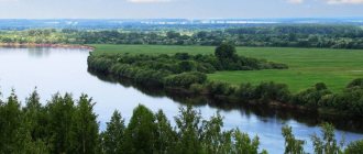
The river flows from Lake Lovatets and flows into Lake Ilmen. The length of the river is 530 km, the basin area is 21.9 thousand km2 - the 1st in length and 2nd in basin area (after the Msta River) river in the catchment area of Lake Ilmen[*]. Main tributaries: Cunha (right); Nasva, Loknya, Redya and Polist (left). There are many lakes and swamps in the basin. In the upper reaches of Lovat there is a chain of lakes connected by channels. Swamps occupy up to 8% of the basin area. The forest cover of the territory is about 50%. In its middle course, the river crosses the Valdai Upland. In this section, the river bottom is rocky, there are many rapids and rifts, the banks are high, often steep. 60 km from the mouth of the Lovat it opens onto the Priilmenskaya Lowland. The river bed is winding and wide (up to 100 m), the river banks are low. When it flows into Lake Lovat it forms a delta. One of the delta branches is connected to the river. Hollow.
The average long-term water flow at the river mouth is 170 m3/s (flow volume 5.365 km3/year). The river's feeding is mixed. Eastern European type of water regime. It is characterized by high floods, low summer low water and rain floods in the autumn. The spring flood begins in late March - early April. When a flood wave passes, flooding is possible. The period of increased flow (second half of March - May) accounts for up to 55% of the annual flow; for the summer-autumn low-water period - about 23%, for the cold period - 22%.
Ice phenomena begin at the end of November. Freezing of the river is accompanied by gluttons. Freeze-up in rapid sections of the river is unstable. During the spring ice drift, the presence of ice cover on Lake Ilmen leads to the formation of ice jams. They are also possible in areas with sharp bends (for example, above and below Velikiye Luki).
The turbidity of the river is relatively low. According to its chemical composition, water belongs to the hydrocarbonate class and calcium group; The quality corresponds to slightly polluted water bodies. The river water is used for water supply. In the river basin there are Rdeisky and Polistovsky reserves.
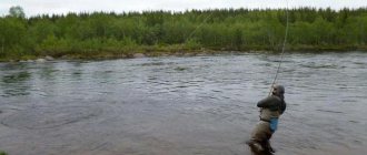
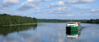
The river is attractive for organizing water tourism and rafting. Navigation is possible during high-water periods of the year from the village. Parfino to the mouth, as well as along the Staraya Lovat branch. The river is home to bream, roach, ide, asp, bleak, perch, pike perch, pike, burbot and others. On the banks of the river are the cities of Velikiye Luki and Kholm.
S.A. Agafonova, V.A. Bug
Source and mouth of the Lovat River
The source of the Lovat River is a narrow watercourse flowing from Lake Lovatets (its maximum diameter is 670 meters). It lies at a low altitude above sea level. Geographically, this is part of the Polesie swamps (namely, a peat swamp called Chistik). Administratively, this is the border of the Nevelsky district of the Pskov region of the Russian Federation and the Gorodok district of the Vitebsk region of Belarus. The landscape surrounding the just described river “start” is peat bogs and lush meadows. However, after 1.5 kilometers (in Lake Zavesno), the pond begins to be squeezed on all sides by dense forests.
The mouth of the Lovat River is the entrance to Lake Ilmen, which is a complex estuary. The main channel has a width of 420 meters, along with it the lake is replenished by the Staraya Lovat channel. Shortly before it splits into channels, the reservoir comes into contact with the Pola River. Geographically, the location belongs to the Starorussky district of the Novgorod region. Both banks are already low. They are dense floodplains along which the branches of tributaries run. The nearest settlement is the small village of Vzvad. In the east, the estuary, consisting of more than 25 watercourses and lakes, borders on the neighboring Sinetskoye Bay of Lake. Ilmen.
Geographical information
Length 530 km, basin area 21,900 km². The Lovat River begins from Lake Lovatets in the Vitebsk region of Belarus. It flows into the southern part of Lake Ilmen, 7 km north of the village of Vzvad in the Starorussky district of the Novgorod region of Russia, where, together with the Pola River, it forms a delta with an area of about 400 km². The channel is winding, the flow speed and depth are uneven. The pools in some places reach 5-6 meters in depth, but sandy and rocky shoals that form rapids are also often found. The main rapids are concentrated at the confluence of the Loknya River and below the city of Kholm (Novgorod region). In this place, the width of the river reaches 50-60 meters, and after the confluence of the Kunya River - already more than 100 m.
Main tributaries: Polist River (lv), Redya River (lv), Loknya River (lv), Kunya River (lv). In addition to rivers, many lakes flow into Lovat: Blagi, Bludenskoye, Galkinskoye, Glubokoye, Tens, Oaks, Zhirokhlitskoye, Zanyusskoye, Zaorlitskoye, Indyuk, Kadolovskoye, Kalenoye, Kamenets, Kisloye, Kisloye, Koloushinskoye, Kupuyskoye, Lenostovo, Lyubzhir, Nespo, Odgast , Orelye, Osplya, Ostrovno, Porechye, Psovo, Sekuy, Sennitsa, Sereberskoye, Serutskoye (Siroto), Sitnoye, Snezhye, Sokoto, Sorito, Cloud, Ulishchevo, Khrebtovskoye, Chagodovskoye, Chistoe, Chistoe.
Basin of the Lovat River
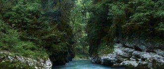
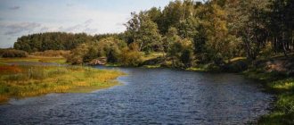
Already for the first kilometers the Lovat River falls into a very narrow valley cutting through the Gorodok Upland. The width of the stream itself is no more than 10-15 meters. But it passes through the spacious “mirrors” of the Pskov-Vitebsk Lake District, where the river floodplain meets coniferous-deciduous thickets (pine, spruce, alder, birch, ash, aspen and willow). The edges on both sides are extremely low. Overgrown with reeds. Beyond Lake Vorokhobsky the river “body” briefly expands to 225 meters! We emphasize that in Polesie the floodplain is very swampy in many places. The further (Pskov) course of the Lovat River is remembered by the Velikiye Luki section. The most winding, wide and fast. The diameter in this section ranges from 150 meters (Velikie Luki, near Dyatlinsky Island) to 40 meters (Kartsevo). Along its entire length there is proximity to large lakes. By the way, it is worth noting that the upper and middle basins of the Lovat River meander strongly for a reason. The channel passes between the hills of the Bezhanitskaya, Sudomskaya and Valdai uplands, which are of moraine (glacial) origin. Moreover, it is at the end of the middle section that the hydrological object crosses the spurs of Valdai, descending at the end along rapids and rifts. The banks are often steep and quite high. Only here are outcrops of different colored clays and sandstones visible. The lower basin of the Lovat River is marked by a passage through the wider Priilmenskaya lowland, from which the narrow Prilovatskaya plain is leveled (it divides the named lowland into exactly two halves). Here the oak joins the river floodplain rich in species composition. And a water lily appears in the water. The number of meanders does not decrease. Starting from Pogost, the forest disappears. Oxbow lakes appear (the river changed azimuth many times) and floodplains. The current speed is low on flat sectors of the route.
Sights of the Lovat River
Lakes Zavesno and Zadrach
In this Belarusian place, the Lovat River plunges into the first fairly large natural pools. Here they were inspired by the famous works of Marc Chagall and Kazimir Malevich, who could not imagine life outside the Vitebsk Lake District. Vasil Bykov immediately wrote his notes for future novels about the battles of the Second World War (by the way, he was also initially interested in painting - of course, such landscapes left no choice...).
The curtain measures 1,900 by 1,100 meters. Depth no more than 2.4 meters. In the west and southwest the floodplain is swampy (peat deposits, lingonberries, shrubs and goosefoot vegetation predominate). On other parts of the riviera we see moraine ridges with birch groves and deciduous trees. Bream, pike, perch and crucian carp are found in abundance. The shallow water is sandy. Extensive. Large drainage area thanks to numerous streams.
The dimensions of Zadrach are 1,900 by 650 meters. The shape is an oval with a large number of bays. The depth of the tank is more than 6 meters! The settlement of Zadrachye grew on one of the edges. To the already mentioned fish, rudd, roach and molt are added here. The landscape is the same. But the shallow water is narrow. The floodplain is not wide. Wild raspberries, strawberries and hazelnuts grow around. All these water surfaces are popular due to the events of the 40s of the last century (in July 1941, the entire Gorodok region of the Vitebsk region was occupied by Hitler’s troops, until December 1943, punitive fascists killed thousands of villagers)…
Only near these places (judging by the excavations) did the Neolithic hunters manage to escape from the merciless warriors of the Fatyanovo culture (a branch of the Battle Ax culture)…
Lakes Butyka, Sosna, Czarniasta and Sesito
A picturesque holiday on the Lovat River is available to “watermen” here too – on the border itself. The first lake is 1,300 by 1,000 m, the second is 1,550 by 1,000 m, the third is 2,100 by 1,400 m, and the fourth is 3,400 (the length along the fairway is the longest in the entire system) by 1,300 meters. All of these flowing pools also do not exceed a depth of 6 meters. They lie in shallow hollows. There are a sufficient number of convenient sandy capes. Water lilies and pondweed grow in the bays. There is also firewood - there are thickets of aspen, black alder, birch and ash everywhere. Among the bushes here are wild raspberries. In the depths, ide is also caught.
Vorokhob Lake
This is the first “civilized” site on the Lovat River. Here it passes through the largest water bowl on its way, and after a couple of kilometers it comes into contact with the first highway - Borisogleb - Porechye. The width of the lake alone is 2,700 meters. But the fairway stretches for as much as 2,800 meters (second in length only to Secito). Area – 2.3 sq. km. Unlike other extensions, Vorokhobskoe lies directly in the center of the Lovat channel. It has changed many names. Speaking about Lake Vorokhobskoe, we will also include catfish and pike perch in the ichthyofauna presented above. The entire perimeter was divided among emerald broad-leaved tracts. And also meadows and swamps. Behind the natural pool, the hydrological object expands once again (this is called Lake Koryto).
Lake Komshino (Komsha)
And at this point the Lovat River is also famous. Protection from garbage and water pollution by nets is very necessary (picnic lovers and irresponsible fishermen have heavily littered the local “wild” biocomplex). So, the mouth of Emenka eventually turned into a lake, which was named Komshino. The expansion has a lacustrine character already behind the dam (the Borka-Komsha-Nikulino “asphalt road” runs along it). Extended over 2,500 meters. Its largest diameter is 350 meters. On the coast, small rural municipalities live their quiet lives - Komsha and Bardino (from each to the water there is a dirt road). The resource is highly flowing. The water is perfectly clean. All kinds of fish. Pike bites best. An ideal nickel for a “wild” bivouac. There are both steep, sloping and low water edges. Stones, driftwood, driftwood and pondweed. From the ancient Pskov dialect (Pskovians are a cross between Slovenes and northern Krivichi), “komsha” means “bully” or “brawler.” It’s not hard to guess why the village was named that way, and the lake itself was named after it. It should be clarified that the name Rurik is typical only for these places (in Pskov it is “falcon”). It is quite possible that the Varangians, described as the founders of Rurik’s Rus', were not from Scandinavia at all, but from the Pskov region.
From the region of the strongest mixture of newcomers Scandinavians, northern Krivichi (Polotsk and residents of Pskov), Balts, as well as Slovenes. “Komshit” - to beat someone, “to crush someone’s sides.” Considering that “Varangian” is the oldest Slavic word denoting professional warriors, the concept of “fighter” explains everything. Moreover, the root “komsh” - “koms” is found further towards Latvia, on the territory of present-day Latvia itself and to the north (“Varangians”, according to the most ancient chronicles, first settled in the land of “vesi” and “Polotchan”, this is where they come from) called the chronicles of Slovenia). The Emenka River is an important stage of the journey from the Varangians to the Greeks. This has been proven by experts from both narrative and archaeological sources...
Lake Slavuy and Ryzhakovsky spring
In an idyllic fragment, the flow of the Lovat River is adjacent (400 m) to the natural reservoir indicated in the title. Its dimensions are 810 by 580 meters. Depths up to 3 meters. The “crushed stone” of Peski-Yakovlevo runs along the eastern shore. The surrounding landscape is a tall grass meadow, surrounded a little further by a rich natural arboretum (willow, aspen, ash, spruce, pine and birch). There will be no problems with brushwood. It remains to add that in this episode the Pskov-Vitebsk Lake District looks more colorful. The writer Viktor Vasiliev once wrote about the beauties of the current Velikiye Luki region: “The huge spruce tree is heavy in lifting branches with dark green needles”...
A water wanderer will encounter a consecrated spring a few kilometers below. In the village of Ryzhakovo. Little is known about him. Besides the fact that it flows right through the center of the village, being surrounded by a narrow strip of floodplain made of ash and aspen. By the way, there is a font.
Museum of Sofia Kovalevskaya in Polibino, Velikiye Luki, animal sanctuary
Further rafting along the Lovat River will lead the traveler to a beautifully restored estate located in the suburbs of the village of Polibino (the river basin is connected to the rural areas by a short stream, and on the other side Balazdyn flows into the main stream). The building has pinkish-cream shades. It was built in the eclectic style, popular in the last years of the century before last. The first Russian female mathematician, Sofya Kovalevskaya (née Korvin-Krukovskaya), once lived here. The Korwin-Krukovskys are a Polish noble family that dates back to the Lithuanian Glinsky dynasty, which, in turn, originated from the Pskov-Belarusian borderland. And that is, from the same ancient Polotsk Venets, to whom both Princess Olga and the first wife of Prince Vladimir belonged... In Polibino there is a gymnasium named after an outstanding compatriot. Her pupils always organize a folklore festival at the museum-estate on Kovalevskaya’s birthday. Few people know, but Sofya Vasilievna was also a playwright. Yes, I was also interested in music. Therefore, on this significant day, the halls of the estate become the stage for performances based on her wonderful plays.
A meat-processing plant known throughout the country, a whole set of local history gems of ancient origin (the Kremlin and burial mounds), picturesque restored churches (churches of the Holy Ascension Monastery), the Obelisk of Glory, the Matrosov Museum (with his figure), the Local History Museum and Vinogradov - these are the main brands of the one mentioned in the first line of the district center. Its population numbers over 100,000 people. The name of the object speaks for itself - Lovat bends here in the most incredible way. And too many times... Some mentions of the settlement date back to 1166. Although, judging by the finds, it stood there since the 7th century, serving as a primitive fortress of the Krivichi-Polotsk people. They subjugated the Baltic aborigines at that time. Adjacent to the villages were very long mounds, in which members of the clan, outstanding in military affairs, were collectively buried (along with all the required ammunition and weapons). Luke went through the so-called “path of the warrior” and only as a reward for this became Great in the 15th century. The fact is that at first they had to fight for the independence of the Novgorod Land, first from the German knights and Moscow, and in subsequent centuries - against Livonia, Lithuania and Poland (already in the 15th, 16th and 17th centuries). But the troubles did not end there. They continued during the Second World War (the city was liberated by tankers, and therefore the T-34 was installed at the prevailing level). Now the city is made up of bright, neat neighborhoods. It is noteworthy that Catherine the Great, in memory of the valor of the townspeople, changed the city coat of arms - the bows became not river bows, but those from which they shoot (in the amount of three pieces) ...
Velikoluksky Zoological Reserve was “born” in 2005. It starts 15 km north of the just described regional center and reaches the Lopatniki tract. That is, it is adjacent to the settlements of Maryino (in the south) and Kostrovo (in the north). Beavers and other near-water (including flying) game are rescued here. You can get up with tents. Hunting, cutting down forests, building dams and all other structures - no. Here they begin to divert canals from the main channel to the agricultural lands of the nearest villages.
Firsanov Bor tract
Beyond Velikiye Luki the shores cease to be low-lying. What do future sites on the Lovat River have in store for us? Firsanov Bor stretches along the riverbed for exactly a kilometer. The rich, dense tree stand comes close to the water. We are talking about aspen, ash, black alder, oak, willow and hazel. And, of course, about pine (it’s not for nothing that the word “pine forest” is present in the toponym). The entire building of the same name was located here before the events of the last great war. In front of the object, the water flow seems to be wound into a ball - Lovat manages to make 8 loops in a space of 1,500 meters. Inside the onion is an oxbow. Not far away (downstream) on the eastern side is Kurova Gora - the first river ravine (height only up to 4 meters). And on the cliff is the namesake village. Here the middle fragment of the path begins to slowly come to an end - the river slowly crosses the spur of the Valdai Ridge...
Lovatskie Porogi and the WWII Museum in Borki
The height of the banks begins to steadily increase towards the north, reaching a height of 50 meters closer to the Lovat rapids. It is here that the riverbed ends up in a wide basin (the diameter is now 40 - 120 meters). It was in the historical tract Podberezye in the mid-10th century that Princess Olga built the Trinity-Khlavitsa churchyard. Later, a rich monastery grew there, which was robbed more than once by the Lithuanian knights and their Krivichi allies, who hated (along with the Drevlyans) the Rurik dynasty. Olga herself was from a Polotsk family close to them, but not a noble one. And at the end of the 16th century, the Muscovites were already fighting here with the Polish army of Stefan Batory. Podberezye, Malye and Bolshiye Borki (“Borkovskaya volost”) - all these are landmarks that provide us with an indication of natural beauty and one artificially created historical object. In the nearest villages, researchers found 6 groups of settlements and burial mounds dating back to our era.
So, the thresholds. Rafting down the Lovat River finally reaches a rapids and rolling section. It exists only here - at the border of the middle and lower reaches. It is even included in the register of protected areas - like the Velikoluksky Zoological Reserve (see above about it). In place of many rocky rifts and “steps,” the stream suddenly narrows to 20 meters (and later expands everywhere again). And all this from Podberezye to the very mouth of Zagarka (sections below Kholm). That is, about 100 kilometers of “attraction”. It is here that the reaches are the widest, and the banks sometimes reach a height of 50 meters, exposing clay rocks of all shades of the rainbow... All these 100 km are a must-see.
The literary and artistic exhibition in Borki is a building made up of a pair of two-story houses. Its premises contain material reminders of front-line writers and front-line artists. The institution was opened by writer-publicist Ivan Vasiliev. This happened in 1988. The fund contains thousands of items.
Reserved lake Polisto, the city of Kholm and Rdeisky reserve
The Lovat River also provides us with a rich list of natural attractions here. To the west there is a neighborhood with the buffer zone of the lake-reserve Polisto. All adjacent swamps are protected objects (this is part of the largest peat bog in Europe). Together with the Rdeiskie swamps, they are the main regulators of the water level in Lake Ilmen, as well as the main filters of all local rivers and streams. The swamps have preserved a relict biocenosis. Lake Polisto is 8 kilometers long and 5.3 kilometers wide. On the outskirts of the GZ there is also Lake Tsevlo. The term “polist” in the Slovenian language meant “dangerous quagmire.” And indeed it is.
The town of Holm is “stuck” between two of the largest areas of raised moor in Europe. In addition, Lovat continues to descend through its most beautiful rapids here. Moreover, this city has great historical value. Therefore, it is difficult to overestimate it. Its name is “speaking” - the cultural core of the agglomeration is indeed concentrated on the hills. Virgin forests, the Heat Swamp, a road bridge, ancient estates, the mouths of tiny rivers, the Tikhvin Temple - these are the main assets of the town. There are also 2 local history centers. One of them is dedicated to the history of the development of printing in Russia. The hill is very green - there is an Arboretum, a City Park, and a public garden on Vladimirsky Boulevard. Note: there are two comfortable sandy beaches and a good hotel “Lovat”. The main pool meets the Cunha River, on which (away from the residential areas) you will find a small waterfall. They christened it romantically: Blue Lagoon...
The protected area “Rdeisky” comes into contact with the river on a fragment of the swamp of the same name (the transition from the Kholmsky to the Poddorsky district of the Novgorod region). The value of this type of swamp was described in the first paragraph of this section. The State Zone is also distinguished by the presence of the border between the taiga and the zone of broad-leaved forests - this is where it is the clearest. It should be noted that in an impassable area on the shores of Lake Rdeiskoe lie the remains of a monastery of the same name, which, nevertheless, is again a church parish. Cranberries, cloudberries, blueberries, lingonberries, and marsh wild rosemary grow on marsh pigweeds.
Regional center Parfino and the Lovat estuary
At this point, the protection of the Lovat River is also more relevant than ever. Parfino is the “capital” of Lower Lovat. There are plenty of sandbanks on quiet backwaters and picturesque lakes. Islands. True, they are not too wide. This point appeared on the map in 1495. Like the village of Parfeevo, born on the site of an ancient Slovenian settlement. It was renamed Parfino only in 1539. This entire area has always been part of the Shelonskaya Pyatina of the Novgorod Republic. And from the Romanov period - in the Starorussky district of the Novgorod province. In 1910, on the other side of the river, the merchant of the first guild, Dmitry Lebedev, built a manufactory for the production of plywood, which grew into a reputable plant during Soviet times. The influx of workers ended with the fact that in 1938 the large village grew into a workers' settlement. After all, the railway track was also installed here. In August 1941, Parfino was occupied by the Nazis. In February 1942 – liberated by the Red Army. After another 26 years, the village turns into a regional center. And a little later - also to a resort (several recreation centers and one pioneer camp were opened in the area). What will we see in the historical core? Monuments to Lenin and Soviet Tankers. Memorial to the Executed Red Army Soldiers (near the station). Church of Sarov. Parfino lies on two banks at once, connected by railway and road bridges.
The joint delta of Pola and Lovat is a unique natural object at the southern end of Ilmen. It was awarded the title of a nature reserve. In addition, the Parfinsky district is the largest concentration of ordinary, hunting and fishing camp sites. The shores here are just convenient. It is typical that the water level is not constant. The labyrinth of channels (decorated with floodplains) hides endangered flora and fauna. The part open to fishing is widely used for leisure by fishermen. Or fall waterfowl hunters. In addition to them, workers from two fishing farms operate motor boats. Their metal shallows (net traps) catch pike, pike perch, roach, silver bream and particles. Most of the fishermen live in the village of Vzvad, surrounded by river water on three sides. In the estuary, one bank is even wider than the main channel (Lovat itself). This means Old Lovat. Lost among the branches are lakes Sitnoye, Chagodovskoye, Zhirokhlinskoye, Galkinskoye. There are also 4 smaller ones. At the very beginning of the fork, Pola merges with Lovat (this point is surrounded on both sides by 2 raised swamps - Dryaby and Black Forest). As a result, we can say that both rivers, all swamps and all channels of the estuary have exits into each other. Fishing camps stretched from the village of Khmelevo to the already mentioned village of Vzvad...
Lovat River
lake Mezha - Velikiye Luki, 155 km (5-7 days) Kilometers along the route>>>>
The route passes through a sparsely populated area. There are many forests along the banks, mostly deciduous. The banks are high and often steep. Sometimes the river flows for many tens of kilometers in continuous thickets of bushes and trees. Lots of rubble, incl. impassable, snags, fallen trees. The river is diverse: deep reaches and swampy areas alternate with small rocky rifts. The 60-kilometer section in front of the city of Velikiye Luki is especially interesting. The river flows between hilly banks with steep slopes, the bottom is rocky, and there are many underwater and surface rocks, rifts and rapids in the riverbed. Depths up to 2-2.5 m. The water is clean, there are a lot of fish. At the beginning of the route we take the train to the station. Town, then walk 4-5 km to the bus station. Then take a bus to the village of Mezhi. You can collect the boats in the pine forest near the remains of the House of Culture on the western shore of the lake. Sosno. The first 30 km are mainly along lakes, and if there is no headwind, it is not difficult to pass. The banks in this area are marshy. Convenient places to spend the night can be found on the northern shore of the lake. Mezha at the exit, not far from the bridge; On the right bank of Lake Chernyasto in the middle part there is a high sandy cape covered with pine trees. On the lake Secito: the right bank is swampy, the left bank is hard and flat, but there is little firewood there and the village is close. Beyond the lake, the river passes into the territory of the Russian Federation.
Below the village of Ryndino, the valley of the Lovat River gradually narrows, and the flow speed increases. On the swampy banks there are continuous thickets of reeds and alder. This section stretches for about 15 km, there is nowhere to stop. Lovat then enters the forests. The banks are high, densely overgrown with alder, bushes and nettles. There are still no parking spaces. Stones appear in the riverbed. In front of the village of Zadnee Selo the river comes out of the forest and winds through meadows, the banks are muddy. A kilometer beyond the village the forest approaches again. There are blockages in the river, sometimes requiring removal or clearing. In the area of the village of Berezovka (Berezovka - Brui road) there is a wooden bridge with a blockage in front of it. Passage on the left bank. (This email address is being protected from spambots. You must have JavaScript enabled to view it. 2008. The wooden bridge in the Berezovka area rotted and collapsed completely, only the piles remained. On our water (May) it was possible to walk under both the left and under the right bank). There is a solid bank here, a good approach, a lot of firewood. This is the best place at this stage to stop. Below the bridge, parking areas appear in the form of clearings and a gently sloping bank, but the coastal edge is muddy, which makes mooring and unloading very difficult. With the confluence of the river near the village of Kuzmino, the forest ends. Below the village of Kuzmino, the tortuosity of the river decreases significantly, especially when approaching the lake. Vorokhobsky. Behind the village of Kaloshino, 4 km along the left bank, there is a wonderful parking lot: a flat, solid bank, a large flat clearing, bordered by forest. There is a good place a kilometer down the right bank in a pine forest with convenient mooring. Gradually the forest recedes, the river valley becomes wide and swampy, with many oxbow lakes, and remains so until the village of Safronovo. Immediately behind it, on the right bank of the Lovat, it’s a good idea to stop and rest. The next parking place can be found between the villages of Borok and Gushchi. There are several good places, but the best is on the right bank behind an abandoned farm.
Lake Vorokhobskoye is heavily overgrown, making movement difficult. The banks are swampy, marshy, only on the eastern shore there is a solid area and forest (immediately at the entrance to the lake). A farm can be seen nearby. The river outlet must be looked for in the southwestern corner of the lake. It is not visible from the water, so you need to stay 500 meters south of the pine forest, and focus on the low coastline (the upper edge of the forest). Further Lovat is wide, 50-100 m, the current is weak, the riverbed is heavily overgrown. Then the banks narrow. At the exit from the lake there is the village of Borisogleb. A forest stretches behind it for about 4-5 km, first damp deciduous, then mixed and pine. The banks are rising. The first parking spot is located 1.5-2 km behind the village on the right bank. Below you can choose 2-3 more places. Then the forest retreats, the river comes out onto the plain, flows through the swamps, and breaks up into branches. Below the village of Sivtsevo, deciduous forests begin, which give way to thickets of alder and willow along the banks. Approaches to the shore and conditions for mooring and disembarking are poor. Closer to the village of Komsha, the floodplain narrows and the tortuosity decreases. In the village there is an old destroyed bridge, there is a blockage in front of it. Wiring possible. Below Komsha, the Lovat channel is wide and overgrown, gradually narrowing. First, single stones appear in the riverbed, then rocky ridges, on which small riffles are formed. The closest place with a flat, hard and bare shore is 3 km below the village near one of these rifts. Behind the village of Stukany there are beautiful places: high banks, dense deciduous forest, rifts.
On the approach to the village of Polibino, rapids begin that require attention. Due to the steep banks and dense vegetation, it is impossible to find a parking spot. And just opposite the village itself there is a meadow with a good exit. It's better to go a little lower. On the right sloping sandy bank there is a birch grove, behind it are the remains of an old wooden bridge. There is a good place to spend the night in front of the bridge (Polibino - Nevel road): on the right bank there is a solid, gently sloping bank and a clearing with pine trees. Below, the river is shallow, the riffles follow one after another with increasing difficulty of passage and rather resemble small rapids. All obstacles are passable and pose a danger to kayaks only when the water level is low. In some places, Lovat is divided into branches, forming small islands. The river remains like this until Velikiye Luki. Closer to the village of Kupuy it is not difficult to choose a parking spot.
In Velikiye Luki there is a small dam behind the railway bridge. Drift along the left bank. When the water is high, it is possible to pilot an unloaded boat. You can finish the hike in the city center, before reaching the bridge. The railway station is about 3 km.
Kilometers along Lovat: clarified by Gavril (eNGiNe) 2008
| Mezha village | 0 | |
| 13 | Border with the Russian Federation | 13 |
| 21 | Rydnino village | 8 |
| 47 | village Kuzmino | 26 |
| 62 | Safronovo village | 15 |
| 76 | Lake Vorokhobskoe | 14 |
| 81 | Borisogleb village | 5 |
| 97 | Komsha village | 16 |
| 113 | mouth of the Balazdyn river | 16 |
| 134 | Kupui village bridge | 21 |
| 155 | V.Luki | 21 |
Tourism and recreation on the Lovat River
The Lovat River is located within that part of the “benign” temperate climate, which is softened by proximity to the seas of the Atlantic Ocean. In January it is no colder than minus 5, and in July it is no hotter than plus 22 degrees. The only problem is that there are a lot of cloudy days and a little more rain than we would like. Humidity accumulates abundantly in this land - that’s why there are so many lakes, swamps, fields and streams. This is the same reason why the forest is so diverse! Hiking relaxation is the main activity for tourists, and jeep safari and rafting are for extreme sports enthusiasts. In autumn, “mushroom” and “cranberry” tours are popular (there are enough cranberry reserves in the described area). And, of course, hunting. Crushed stones, dirt roads, and walking trails are a joy for cyclists. What serious transport arteries lead here? Firstly, the railway tracks of the Nevelsk and Starorusskoe directions intersect with the Lovat shores more than once. And, secondly, such highways as E-95 (St. Petersburg - Odessa), Gorodok - Velikiye Luki, Velikiye Luki - Podberezye, Loknya-Kholm, Kholm - Staraya Russa. There are secondary asphalt roads.
Horseback riding and beach holidays on the Lovat River are ideal on the Velikiye Luki – Yuryevo section.
This same zone is the only region with tourist centers and children’s holiday camps:
- "Forest Tale";
- "August";
- "House of the Hunter and Fisherman";
- "Capercaillie";
- "Brown bear";
- "Rusich";
- "Zhabino".
The fact is that here is the most convenient entry into the water (an excellent swimming pool). There is sand. Swamps at a decent distance from the water's edge. In general, campers will really like it here too.
As for extreme, pilgrimage and event tourism, as well as fishing, the Lovat River provides many opportunities near large settlements and riverbed lakes. Tourism festivals are held in Belarusian Ezerishche. In Velikiye Luki there is an annual ballooning festival (we take to the air with everything we can). In Kholm there is the same regular gathering of patriotic song performers. And in Parfino there is a fascinating event called “Lighting up the Stars” (a gala concert of vocal and choreographic youth groups). Please note that there is a lot of fish everywhere here (it’s not for nothing that most of the recreation centers are built for fishermen)!!!
Rafting on the Lovat River is a popular activity among extreme sports enthusiasts such as kayakers, rafters, kayakers and even lovers of homemade rafts. They usually start where the distance between the banks is already at least 100 meters. That is, from the Pskov Lake District (usually from the village of Borisogleb, which can be easily reached from Porechye, otherwise it is connected by road to the international highway Velikie Luki - Gorodok). The diameter narrows in some places, but does not become less than 15 meters. There are no rubble anywhere. There are a lot of forests of different types. And on the water there are reeds and water lilies (which indicates the ecological well-being of the biotope). The current speed is average. But on the bends it is high. On the right and left there are fireplaces of experienced people. And also birch groves. There are also giant ash trees. A series of rapids are indicated in one of the top paragraphs. I must say that these obstacles are passed without difficulty - with a smile on their face. Commercial water trips also take place. But already beyond the threshold - in the Novgorod region. Most often from Chekunovo (already outside the town of Kholm) to the village of Seleevo (on this stretch a kayaking adventure is suitable even for children). A pleasant feature of the named fragment is the complete absence of bridges. And from Blaznikha you also get a “primer”. Along the banks (they are extremely winding) the cliffs begin to gradually decline. They descend at the end to prosaic 3-meter edges. The current speed is average. There are not so many muddy banks. Besides, no shallows. Among the forests, coniferous tracts, birch and alder forests begin to predominate. River oxbows appear to the side, the banks of which are sometimes more convenient than river banks in terms of parking. And further. For those who want to catch the last rapids, we recommend rafting directly from the town of Kholm. You will be carried away at great speed. At least some experience is desirable, but in general the water excursion will be safe and bright...
Information and literature about the Lovat River
On this page, the Living Encyclopedia website is pleased to present readers with information, materials and literature about the Lovat River.
Content:
1. information about the Lovat River
2. literature about the Lovat River
3. poems about the Lovat River
Lovat River - Encyclopedic reference
Lovat (Belorussian: Lovat) is a river in Belarus and Russia. It flows through the territory of Vitebsk, Pskov and Novgorod regions. On the river are the cities of Velikiye Luki, Kholm, as well as the urban-type settlement of Parfino. Belongs to the Neva River basin of the Baltic Sea. The length of the river is 530 km, the basin area is 21,900 square meters. km. The Lovat originates northwest of Lake Zavesno in the Vitebsk region of Belarus and flows into Lake Ilmen. Lovat has 30 tributaries. The origin of the river's name is debatable. According to M. Vasmer - from the Finnish alve “brood”. According to Yu. V. Otkupshchikov, the name of the river is of Baltic origin. In the 8th-13th centuries, the Volga trade route and the famous route “From the Varangians to the Greeks” (from the Baltic to the Black Sea) passed through Lovat, connecting the Scandinavian countries with Byzantium. The river played an important role in communication between Kiev and Veliky Novgorod. On the right bank of the river, 3.5 km from the Vitebsk village of Lyalevshchina, there is an archaeological site - an Iron Age settlement, and near the village of Mezha - a Neolithic site.
Literature about the Lovat River
River Lovat - POEMS
Autumn over Lovat Lyudmila Pervomaiskaya
When the rains fall over the red leaves, the soul is already sad and despondent. More and more often we sit at home with you. A bright light disappeared behind the cloud.
The fog made its nest over the park and swallowed up the daylight around. And ahead is only damp dope... The yellow leaves of the willow have fallen...
Bright foliage hurries along the river, Like a boat created by a child, And, reflected, the blue of the sky Floats behind it like a thin ray of light.
The garden is emptying, there is smoke on the grass - And this is the smell of the familiar autumn. Well, let's make some tea and sit by the stove. Everything is fine.
After all, despite the autumn and rains, Life goes on. Sorry, but it happens - Winter is already ahead... She's waiting around the corner...
Above Lovat Irena Panchenko
As soon as the slanting ray of sunset peeks into Lovat, I walk over the river in iridescent silence and absent-mindedly catch the splash of a sloping wave, which, having touched the shore, again hurries into the distance.
And beyond the fast river, on a steep mound, engulfed in flames, an obelisk stands. The soldiers sleep quietly during the day and early in the morning, and a white chamomile lies on the stove.
Even though they hoped to come, they did not spare their lives: after all, the same enemy burned their crops. Other soldiers protected their relatives there, and another ravine also became their home.
Again the city looks into the waters of the Lovat River, catching the sun’s rays with children’s hands. And youth walks and wanders along the river path, and over the ancient city there is a fragrant linden blossom.
As soon as the slanting ray of sunset peeks into Lovat, I wander over the river in iridescent silence. And behind it, behind the fast lane, the soldiers are quietly sleeping, and a white daisy lies on the stove.
Reflected in Lovat... Lyudmila Pervomaiskaya
Autumn is reflected in Lovat with the variety of variegated foliage, In September the river is very quiet, Sounds can be heard in the clear air.
How many colors there are in autumn trees - From ruby to gold! I have never seen a mixture of so many bright shades in others,
In city trees, for example, and those make your soul freeze! Autumn is a glorious artist, there is no doubt about how, how good you are!
You always delight artists and poets. The first one will write with a brush, And this one will write a fiery syllable about you.
One of these days, there will be ice drift... Vladimir Pavlov Velikie Luki
One of these days, the ice will break up, Lovat will gain freedom, And will flow in all its glory, Composing a hymn of love to Spring...
Willows on the shore Yuri Volny
The shore of Lovat has become beautiful, and there is something to admire! Among the balls of beautiful willows, It’s nice to take a walk, brothers!
Once upon a time, many years ago, people planted willow trees here. And the ancient city, which was cherished and loved, became more beautiful!
On that beach, in the shade of the balls, It’s nice to lie in the grass. And from the worries and labors of the day, I can go to sleep or surrender to the sun!
I like to walk here slowly and look at the waters of Lovat. Yes, and perhaps it’s a sin for the ladies, But it’s also sweet to contemplate.
Here the waters of the Lovat River flow calmly and majestically. And the thoughts here are pure, light, And the lines are written curly.
Yes, the shore of Lovat is beautiful - Young couples walk here. The foliage of green tender willows is caressed by the daring winds.
And I, with my naive line, am trying to sing about that shore. And capture this wondrous landscape with your verse. *** On April 21, 2012, a cleanup day was held in the city of Velikiye Luki, Pskov region. Bushes of spherical willows were planted on the banks of the Lovat River. A good job was done! This voluntary action inspired me to write this poem.
See information about rivers in the catalog alphabetically:
* * * * * * * * * * * * * * * * * * * * * * * * * * * *
All rivers of Russia (full list of names)
Fishing and hunting on the Lovat River
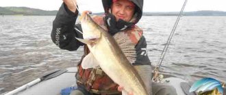
Fishermen like the Lovat River. Fishing here promises an encounter with various delicacies:
- pike;
- perch;
- crucian carp;
- minnow;
- language;
- catfish;
- zander;
- rudd;
- line;
- burbot;
- silver bream;
- roach;
- asp;
- bream.
On the Lovat River, catchers can fish almost everywhere. After all, there are plenty of oxbow lakes and lakes, riffles, deep reaches, fast-flowing channels, quiet backwaters with snags and reeds, as well as floodplains. That is, the water landscapes here are suitable for any fish. The same can be said about Lovat sleeves. There is no point in recommending any one place. Locals and visitors respect casting from the shore, standing on rapids, walking on inflatable boats, “watching” under bridges and even on bridges. As for the type of gear or bait, they are all good here - today this is a proven fact. Attention. Catching ichthyofauna is not allowed in sections of the Polistovsky and Rdeysky reserves. Of course, no nets or poisoning machines.
We remember about the spawning season and about the water protection zones of the 2nd protected area (to do this, just read the signs on the full houses). Among the inhabitants of the Red Book in the waters of the Lovat basin, you will only find the sculpin or the Ukrainian lamprey. There are enough stones in the presented region. You can catch a lot of crayfish here.
This is the joy the Lovat River provides to its guests. Fishing, however, can only be part of a hunting trip, which we will talk about here. There are dozens of hunting grounds along the riverbed (the area, by and large, is not very populated). In the territory of Polesie, in the Pskov region and in the southern Novgorod region, the following game animals are available: wolf (without restrictions), elk (from October 1 to December 31), wild boar (from June 1 to December 31), furs (exclusively from September to December 31 - forest polecat, American mink, otter, marten and fox), hare. Next are small rodents, a badger and a raccoon dog. Brown bear is limited here. Flying and swimming game - wood grouse, black grouse, pheasant, quail, partridge, curlew, nuthatch, turtle dove, snipe, ducks, coot and goose. “Red Books” - owls, all birds of prey, swans, cranes, storks and all kinds of herons.
Protection of the Lovat River
As you already understand, protection of the Lovat River is definitely needed along its entire length. The conversation turned to the issue of “post-picnic” cleanup and abandoned poaching nets. And yet, serious pollution (threatening to change the environmental status of the site) is present only on a 12-kilometer section of the Velikolukskaya agglomeration (here IZ is already defined - “moderately polluted”). But everything above is considered a completely impeccable recreational area. At the moment, the active actions of scientists, officials and citizen volunteers are concentrated around the problem of wastewater from industrial, agricultural and municipal enterprises. The content of pesticides, copper and manganese compounds, and biologically hazardous organisms is exceeded. Slight contamination is also present on many fragments lying below Velikiye Luki.
This description of the Lovat River is intended to outline all the recreational pros and cons of the mentioned “water road”. It also gives an idea of the historical significance of its banks. An interesting feature of the upper reaches of this watercourse is the presence of a cascade of channel widenings, many of which received “titles” of lakes on the map. Alas, in some places the river edge is very swampy. In cities the water is slightly polluted...
0